Distance: 2.5 km | Time: 1 hour | Easy Walk
A gentle walk from Magor Square to Magor Marsh Nature Reserve, past the ruins of Magor Mansion and returning via the magnificent St Mary’s Church.
OS Map: Explorer 154 - BUY
Details
Route Description
Start at Magor Square (Grid Ref: ST 425870)
- Standing with your back to the Post Office, facing the War Memorial, turn left and follow the road out of the square and on to Redwick Road.
- Turn left on Redwick Road, passing the ruins of Magor Mansion, known locally as the Procurator’s House.
- Cross over the rail bridge and turn right towards Llandevenny, then left down Blackwall, an old green lane. Beside the lane is Blackwall Reen, which formed the western boundary of a medieval monastic grange, or farmstead, at Lower Grange. Please note, Blackwall often floods during wet weather.
- Follow the green lane for about 300m until you reach a field gate and kissing gate on the left. This is the entrance to Magor Marsh Nature Reserve. Enter through the gate and head diagonally across two fields towards a kissing gate in the far corner.
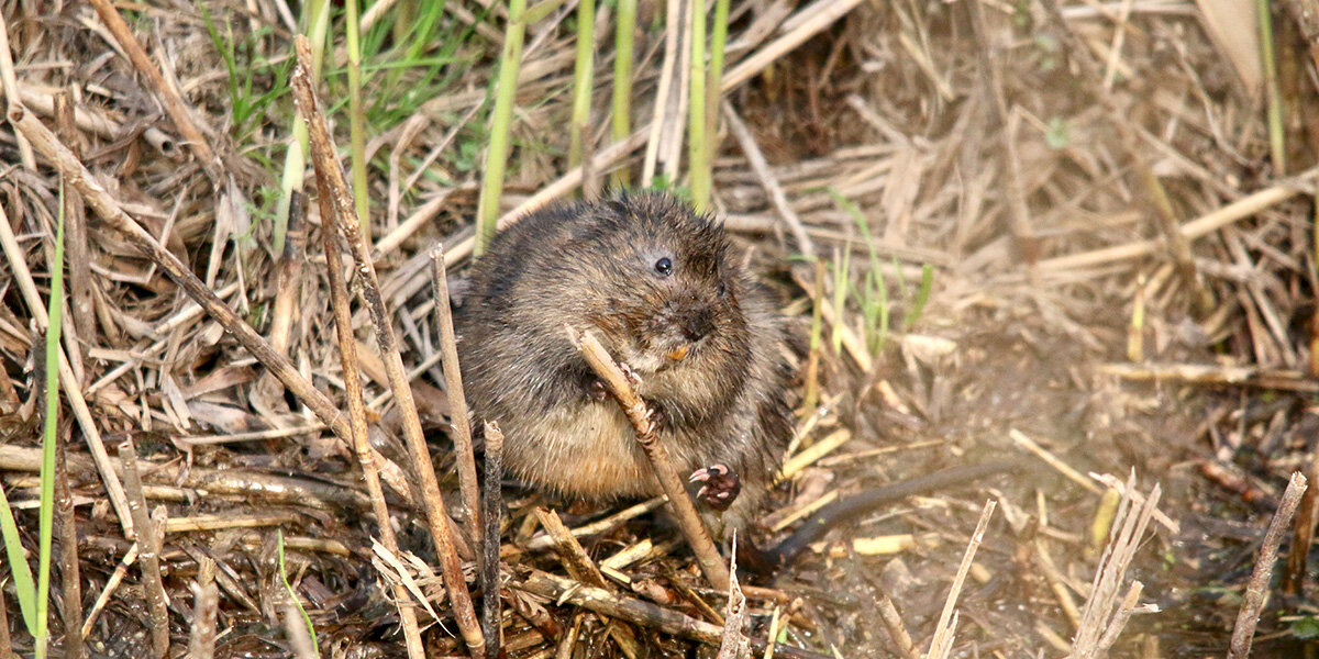
- Go through the gate and follow the path alongside Pwll Uffern Reen. Keep an eye open for water voles. After 50m, turn left through a kissing gate and follow the path along Cwrta Well Reen.
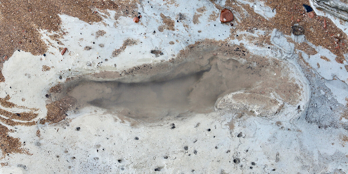
- At the next junction, turn right and follow the path towards the Derek Upton Centre. The building is named after a former reserve warden and keen amateur archaeologist, who discovered many important finds, including prehistoric human foot-prints at Uskmouth, Bronze Age sites at Caldicot and Redwick, and the medieval Magor Pill boat.
Take a short detour on the way to visit the hide overlooking the reserve’s pond, a great place to see kingfishers, egrets, herons and other wildlife.
As you head towards the Derek Upton Centre, look out for ‘The Brinker’, a woven willow sculpture of Anne Williams, an 18th century Levels landowner, scything the reen-side vegetation. Just before the centre, the path crosses Whitewall Reen, the eastern boundary of the medieval monastic grange. - Exit the reserve and turn left on to Whitewall Lane, an old Roman road. Follow the lane back towards Magor.
- At the pedestrian footbridge cross the railway line and follow the path to Chapel Terrace. Turn left and follow the road back towards Magor Square.
- At the end of Chapel Terrace, take a left turn towards St Mary’s Church. After you have explored the church, follow the path through the churchyard back to Magor Square.
Walk Highlights
Magor
The large village of Magor lies on the inland edge of the Gwent Levels. The name derives from the Welsh Magwyr, meaning wall, which may refer to flood defences or to the ruins of a now lost Roman villa.
Magor once had its own port on the coast called Abergwaitha. The port was abandoned sometime in the 15th century and coastal erosion has destroyed much of the evidence of the earlier settlements. In 1994, the wreck of a 13th century boat was discovered buried in the estuary mud close to Magor Pill.
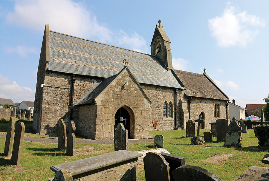
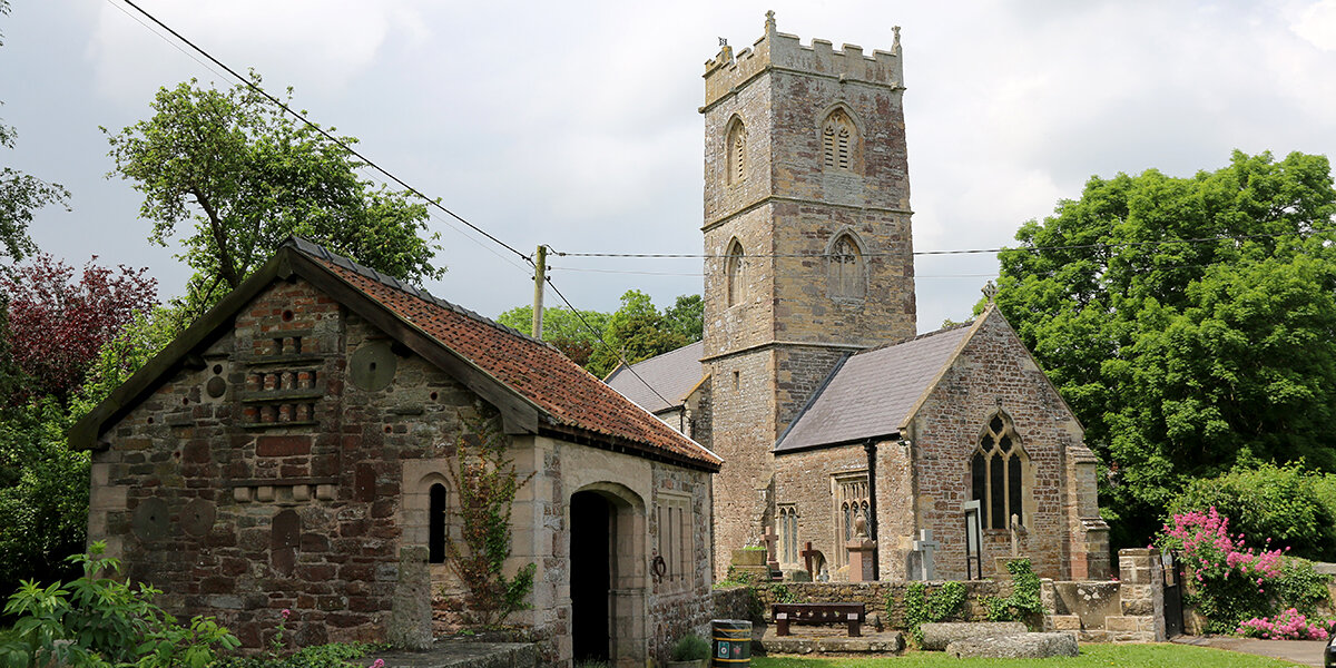
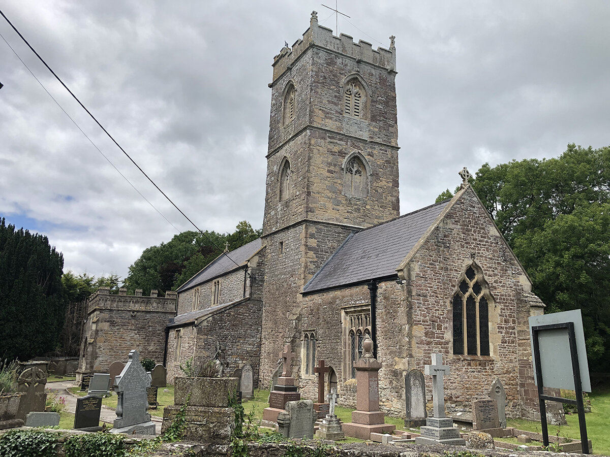
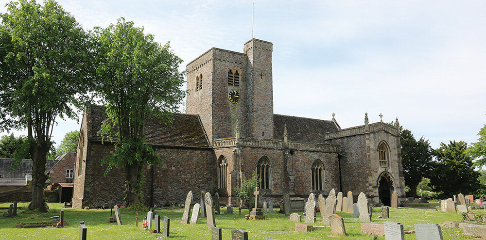
St Mary’s Church, Magor
A large church with a central tower and two storey porch. The oldest parts of the building, including the tower and chancel, date from the 13th century, although it may be on the site of an earlier 7th century church founded by Cadwaladr, King of Gwynedd.
Sections of the church were rebuilt in the 15th century and the ornate porch was added in around 1520. The room above the porch was once used as the village school.
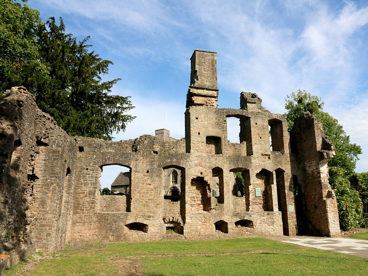
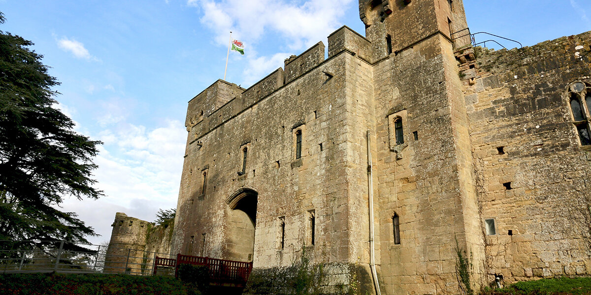
Magor Mansion (The Procurator’s House)
These impressive ruins date from the 16th century and originally belonged to the Vicar of Magor. The mansion is known locally as the Procurator’s House, although this probably refers to an earlier building which may have housed the treasurer, or procurator, of the local abbey.
The building is two storeys high with a cellar below and is constructed from rough sandstone, with fine ashlar quoins, fireplaces and dressings. The main floor is divided into three rooms, each with a fireplace.
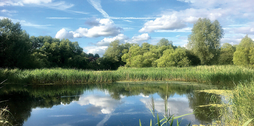
Magor Marsh Nature Reserve
One of the last fragments of fenland on the Gwent Levels, a landscape which has existed here for thousands of years. Look out for little egrets, dabchicks and kingfishers at the pond, dragonflies and water voles along the reens, and butterflies in the meadows. The reserve is owned and managed by Gwent Wildlife Trust and is a Site of Special Scientific Interest.
Please note: Dogs are not allowed at Magor Marsh.
Parking
There is ample parking in Magor.
Dog policy
Dogs are not allowed at Magor Marsh.
Facilities
There are shops, pubs and cafes in Magor.
Accessibility
Several sections of road to cross.
Parts of route may be muddy during winter or wet weather.
Several kissing gates.
Downloads
▶ Download walking route leaflet (PDF 2.5MB)
Always follow the Countryside Code.
- Consider the local community and other people enjoying the outdoors
- Park carefully so gateways and driveways are clear
- Leave gates and property as you find them
- Follow paths but give way to others where it’s narrow
- Leave no trace of your visit, take all your litter home
- Don’t have BBQs or fires
- Keep your dog under effective control and pick up after your pet – dog mess can harm livestock
- Plan ahead, check what facilities are open, be prepared
- Follow advice and local signs
Navigating routes using GPX files
Many smartphones and tablets are GPS-enabled. Using a navigational app, such as the OSMaps or ViewRanger apps, you can use a GPX files to follow a route.
- Install your chosen navigational app before setting out on your walk.
- Download the GPX file from the route page.
- Import the file into your app. How this is done depends on the app you are using.
Please be aware that using your phone's GPS can drain the battery. It is recommended that you carry a paper map as a backup.
Route Map
Please note:
Dogs are not allowed at Magor Marsh Nature Reserve.
Magor Marsh is one of the lowest lying areas of the Levels and sections of this route can flood or become very muddy during wet weather.