Distance: 8.5 km | Time: 2.5 hours | Moderate Walk
This circular route takes you from the magnificent Caldicot Castle down to the coast by the Prince of Wales Bridge, along the Wales Coast Path to the Iron Age fort at Sudbrook, and on to Black Rock picnic site for spectacular views over the Severn Estuary.
OS Map: Explorer OL14 - BUY
Details
Route Description
Start at Caldicot Castle car park. (Grid Ref: ST 487884)
- From the car park, follow the access road to the eastern entrance, crossing over the Nedern Brook. Turn right along Caldicot By-pass. After 250m turn left down Pill Road and follow the road to the end.
- Bear right onto Symondscliff Way and follow the road over the railway crossing and straight on between factory units, through a kissing gate and towards the Prince of Wales Bridge along a tarmacked track. At the end of the track the footpath joins the Wales Coast Path.
- Bear left and follow the track with the bridge on your right.
- After 1km the ground starts to rise towards Sudbrook Point and the path passes through the outer ramparts of Sudbrook Fort, an Iron Age enclosure. Follow the path across a playing field and exit towards the village of Sudbrook along Camp Road, passing the ruins of Holy Trinity Church. A short distance along Camp Road is the Sudbrook Interpretation Centre (housed in the Sports and Social Club), which has a fascinating display all about the history of Sudbrook and the Severn Railway Tunnel.
- Just past the Social Club, turn right across an old railway line on to Church Row and turn right towards the huge pumping station, built in 1886 to house six beam engines used to pump water from the Severn railway tunnel. Follow the road as it bears to the left, passing some of the houses built in the 1870s to accommodate workers on the Severn Tunnel, and follow to the end of the surfaced road, where the track continues onwards towards Black Rock. On the right, as you leave the surfaced road, is the site of the former Sudbrook shipyards. Just before Black Rock the path splits; turn right to go through the picnic site, which has fantastic views across the Severn Estuary, or carry straight on towards Black Rock Rd.
- From Black Rock, follow the road towards Portskewett for 50m then turn right onto a track and bridge over the disused railway to a field gate. Enter field and turn left following the hedge and then the footpath along the old railway line, before emerging onto Black Rock Road. At the end of the road, turn right along Main Rd and then, after 200m, left along a road (signed to Leechpool).
- After 300m, look for a fingerpost and stile on your left and cross into a field. On the crest of the hill on your left is Heston Brake, a Neolithic tomb or long barrow. Cross the field following the waymarking, through a hedge and follow the path along a farm track. Cross into a narrow lane that takes you back on to Main Rd. Turn right and follow the road down towards the village of Portskewett.
- After 150m, look out for the Church of St Mary’s on your left, well worth a detour. Continue down Main Rd. Just before the next turning on your left (Manor Way), the path heads off to the left across Harold’s Field, the site of a Saxon hunting lodge. Follow the path, passing Portskewett and Sudbrook Football Cub and the Cornfield Project Community Garden, exiting next to the railway line.
- Follow the path through some industrial units and on to a line that takes you back to Symondscliff Way. Cross directly over to Pill Row and head back towards the Castle.
Walk Highlights
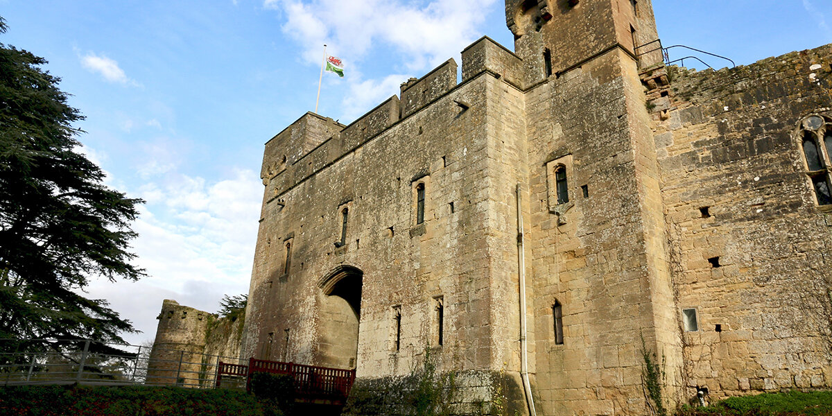
Caldicot Castle
Caldicot Castle was built to guard the crossing over the River Nedern. The original timber motte and bailey castle was built soon after the Normans invaded South Wales in the 11th century. In 1221, Humphrey de Bohun, Earl of Hereford, began rebuilding the castle in stone.
After falling into a state of dereliction, the castle was rescued form ruin in 1855 by Mr J.R. Cobb, who rebuilt parts of the castle as his family home.
Nedern Brook
The Nedern today is little more than a narrow brook but it was once a navigable river that allowed small ships to travel inland as far as Caerwent.
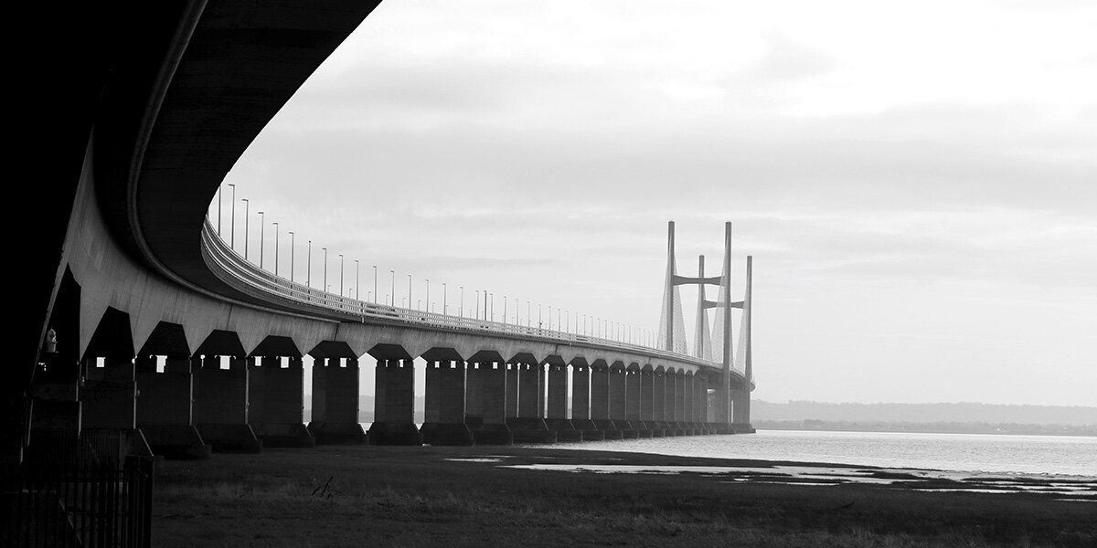
Prince of Wales Bridge
The magnificent Prince of Wales Bridge was opened in 1996. In total, the bridge is over 5km long, with the longest span 456m.
Sudbrook Camp
Sudbrook Camp is an Iron Age fort built sometime in the 2nd century BC. At the time of the Roman invasion it was occupied by the local Silures tribe and may have played host to the Celtic chieftain Caradoc (Caractacus) as he retreated before the Roman Legions. After conquering the region, the Romans may have used the fort as a trading post. The inner ramparts rise to over 5 metres.
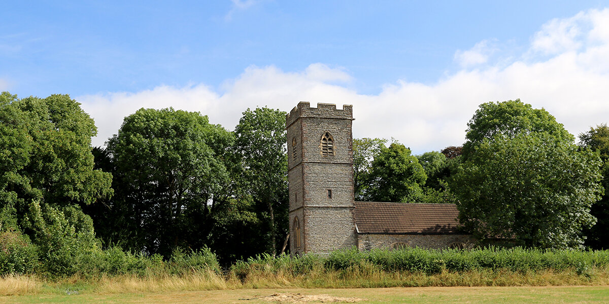
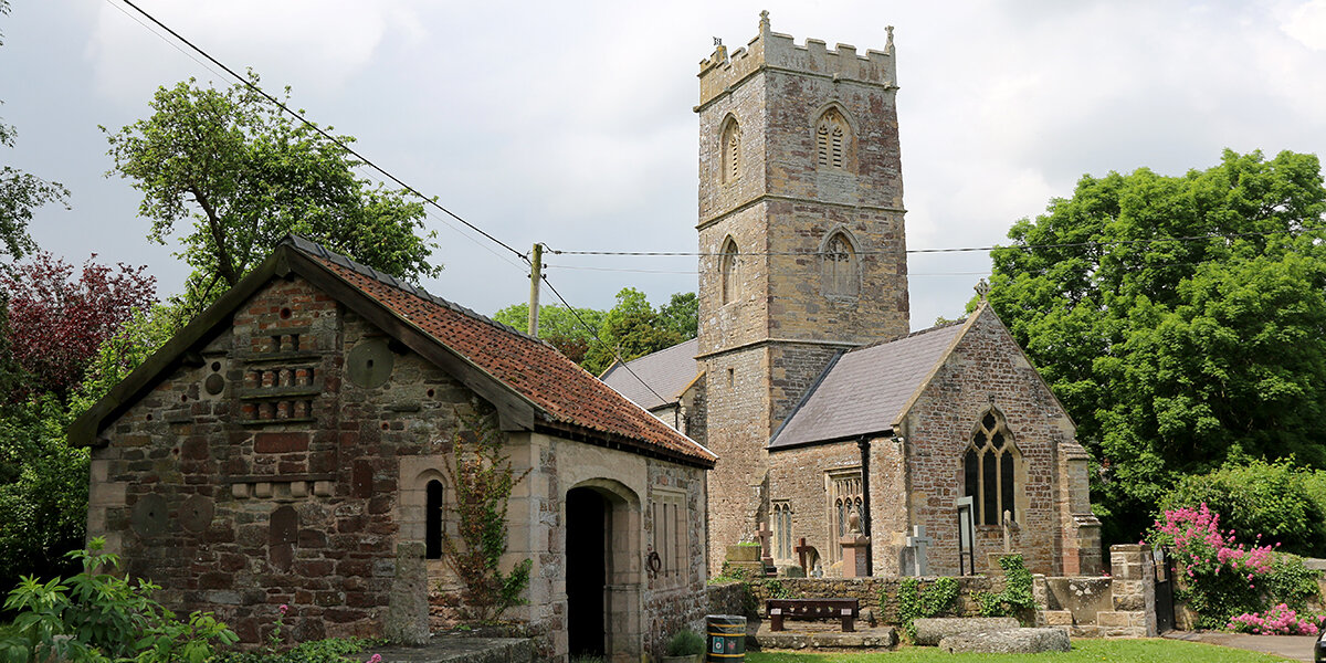
Holy Trinity Church
The ruins of the 12th century Holy Trinity Church stand perilously close to the cliff edge. The church was still in use up to 1560, but was abandoned by the mid 1700s due to the erosion of the nearby cliffs. Much of the churchyard has long since fallen into the estuary and human bones were frequently found on the shore below the cliffs.
Sudbrook Interpretation Centre
Visit the fascinating Sudbrook Interpretation Centre and discover the history of Sudbrook and the Severn Tunnel, Wales' crucial rail link with England. The centre tells the story of the village built in the 1870s by Thomas Walker to house the 3000 workers constructing the Severn Railway Tunnel.
Following completion of the tunnel, the local brickworks, which supplied bricks to line the tunnel, was converted into a ship yard to provide work for the unemployed tunnel workers. Over 100 ships were constructed, the largest and last, the 739 tonne Frensham, in 1922
Free entry (donations welcome). Tea and coffee available.
Sudbrook Pumping Station
In 1879, workmen digging the Severn Tunnel hit an underground river, which completely flooded the tunnel and took two years to drain. The giant redbrick pumping station was built in 1886 to house six Cornish beam engines and used to keep the tunnel dry. The pumped water was supplied to the Sudbrook papermill and a brewery in Magor.
The pumping station still removes around 20,000,000 gallons of water each day, although the beam engines have since been replaced with modern pumps.
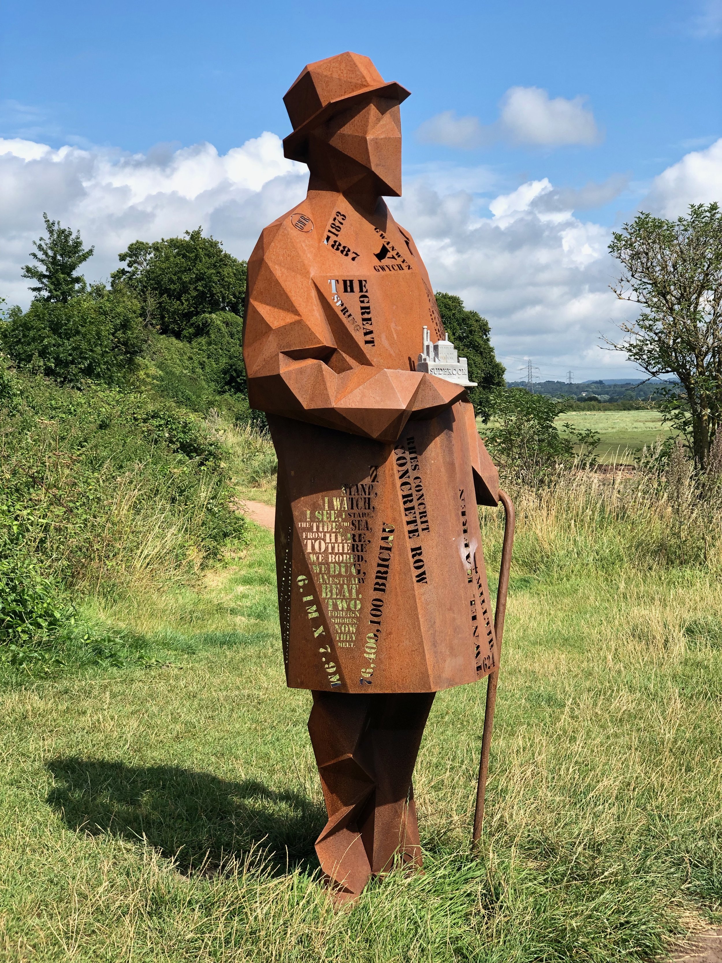
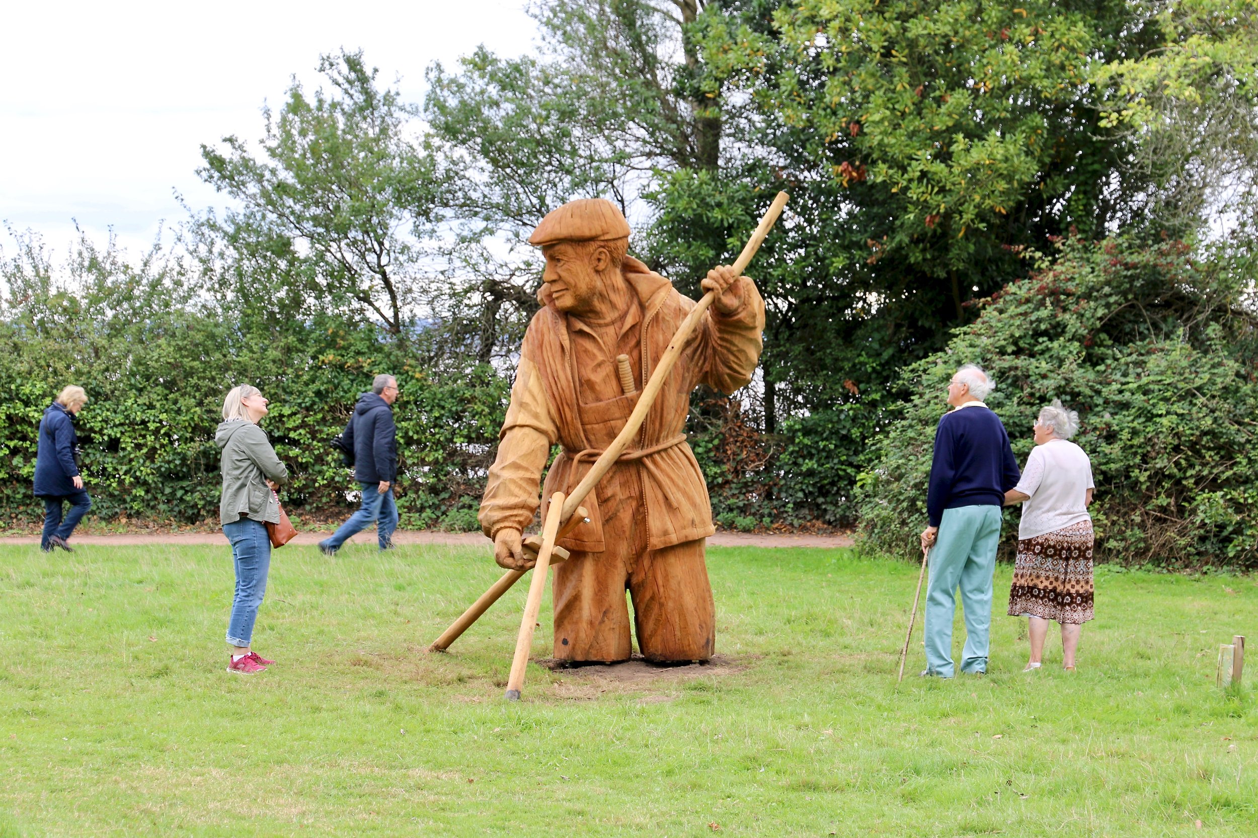
Black Rock picnic site
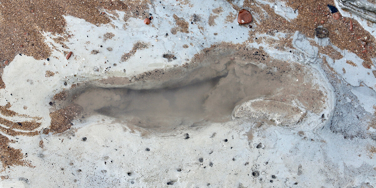
Black Rock has been a crossing point between England and Wales for centuries; Roman coins are frequently found in the mud along the foreshore and are thought to be offerings to the gods for a safe passage.
Black Rock is home to a group of lave net fishermen, who fish for salmon using traditional techniques. It is also home to two sculptures celebrating the people of the Gwent Levels; the Fisherman and the Engineer.
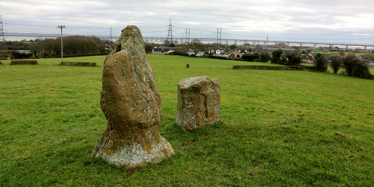
Heston Brake
Heston Brake is a neolithic chambered tomb or long barrow. Much of the mound of earth that once covered the tomb has been removed exposing a small group of puddingstones, which once stood at the entrance to the tomb.
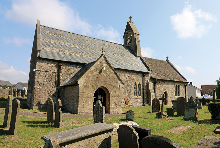
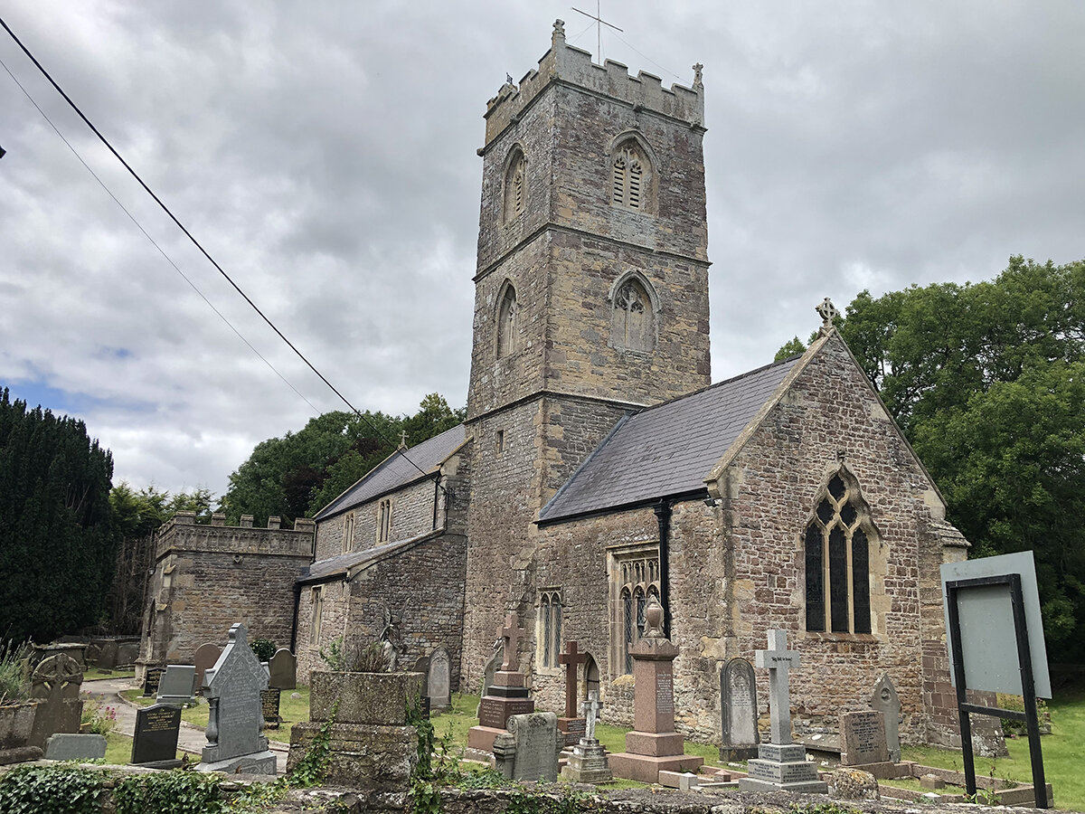
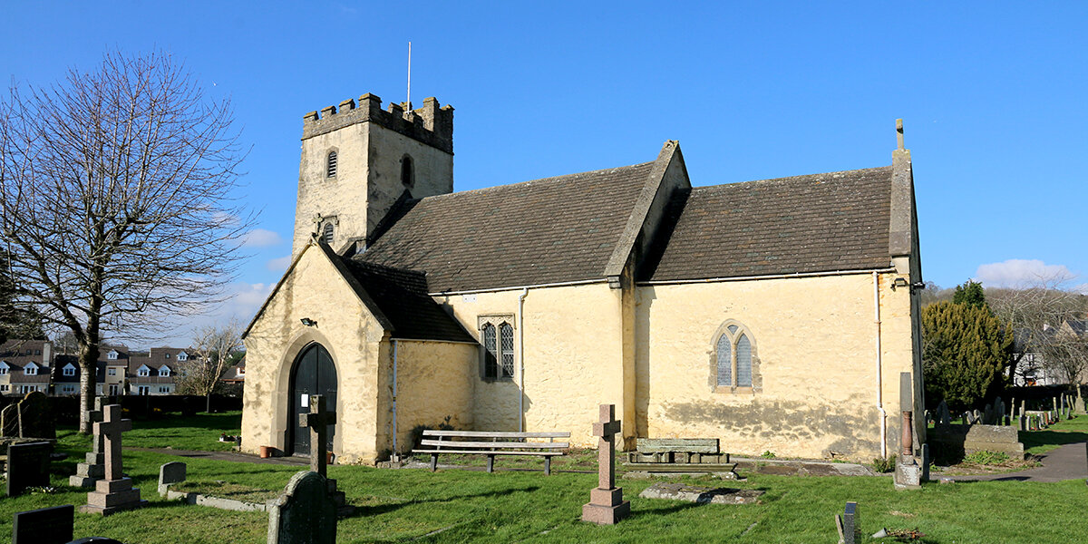
St Mary's Church, Portskewett
The village church of St Mary’s dates back to the late 11th century, but has been extensively altered and extended over many years. Look for the steps in the churchyard that formed the base of a medieval churchyard cross and the carved cross above the blocked-up north doorway, which may be the oldest part of the church.
The field below the church is known as ‘Harold’s Field’ and is thought to be the site of a hunting lodge built by Earl Harold of Wessex in 1065. The building was attacked and destroyed by Caradog ap Gruffydd, King of Gwent, before it was completed. Harold, who was crowned King of England in 1066, never had opportunity to rebuild the lodge. He was killed later that year at the Battle of Hastings.
Parking
There is ample free parking at Caldicot Castle and Black Rock picnic site, and limited parking at Portskewett and Sudbrook.
Dog policy
Dogs are allowed but must be kept under control at all times.
Facilities
There is a cafe at Caldicot Castle and shops and pubs at Caldicot and Postskewett.
Accessibility
Several sections of road to cross.
Parts of route may be muddy during winter or wet weather.
Several kissing gates.
Downloads
▶ Download walking route leaflet (PDF 2.8MB)
Always follow the Countryside Code.
- Consider the local community and other people enjoying the outdoors
- Park carefully so gateways and driveways are clear
- Leave gates and property as you find them
- Follow paths but give way to others where it’s narrow
- Leave no trace of your visit, take all your litter home
- Don’t have BBQs or fires
- Keep your dog under effective control and pick up after your pet – dog mess can harm livestock
- Plan ahead, check what facilities are open, be prepared
- Follow advice and local signs
Navigating routes using GPX files
Many smartphones and tablets are GPS-enabled. Using a navigational app, such as the OSMaps or ViewRanger apps, you can use a GPX files to follow a route.
- Install your chosen navigational app before setting out on your walk.
- Download the GPX file from the route page.
- Import the file into your app. How this is done depends on the app you are using.
Please be aware that using your phone's GPS can drain the battery. It is recommended that you carry a paper map as a backup.