Distance: 13 km | Time: 3.5 hours | Strenuous Walk
Follow the Wales Coast Path from Newport Wetlands to Redwick, through an area of the Gwent Levels steeped in archaeology and history, and rich in wildlife.
OS Map: Explorer 152 - BUY
Please note: This is a linear walk, which can be done in stages. If you intend to do the whole walk in one go, please allow extra time for the return journey. Alternatively, if you are walking with a group, arrange to park a vehicle at the end of the walk for the return journey to the start.
Details
Route Description
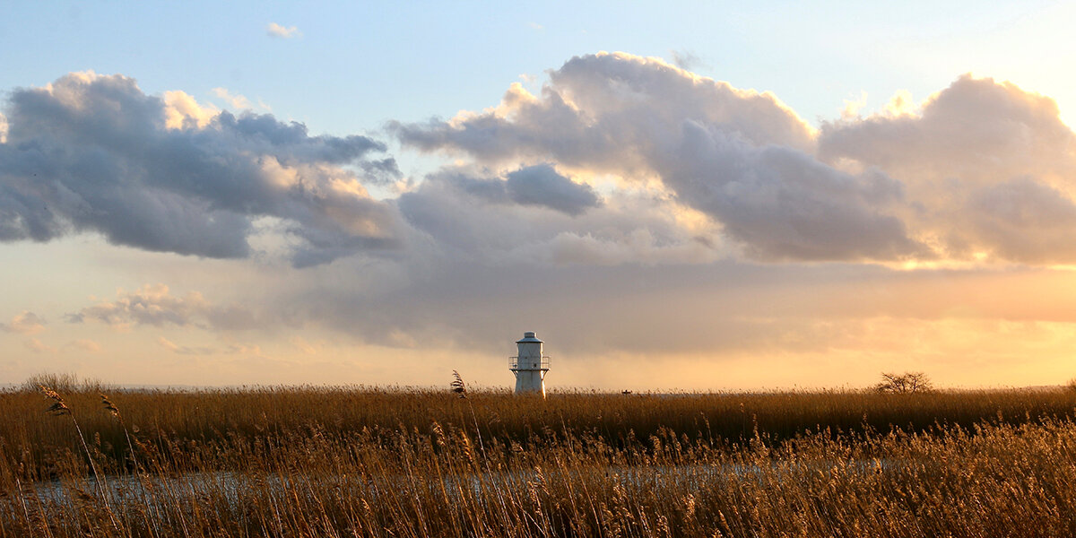
Start at Newport Wetlands Visitor Centre, Nash. (Grid Ref: ST 334833)
- From the visitor centre car park, follow the signs towards East Usk Lighthouse and the coast.
Please Note: Dogs are only allowed in Newport Wetlands along the Wales Coast Path (WCP) and must be kept on a lead at all times. From the RSPB car park, follow the WCP around the outside of the reserve, rejoining the walk route at the East Usk Lighthouse. - From the lighthouse, head east along the coast following the signs for Wales Coast Path.
- The path veers away from the coast following Salt Marsh Lane and Goldcliff Road, before turning towards Goldcliff Pill along Boat Road.
- When you reach the base of the sea wall climb up for a view across Goldcliff Pill towards Goldcliff Island.
- Follow the WCP towards Goldcliff, along Goldcliff Road for a short section, and then down to Goldcliff Lagoons. From Goldcliff Lagoons, follow the WCP towards Goldcliff Island and the sea wall.
- Follow the WCP towards the sea wall, passing the Sea Wall Tea Rooms. Climb up on to the wall and look out into the estuary.
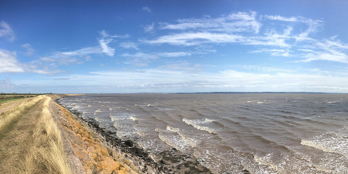
- Follow the coast path along the sea wall away from Goldcliff. heading towards Redwick. Once you get past the small land projection, meaning that you can no longer see the coastal path at Goldcliff, you will have entered the part of the coastal path in Porton.
- Carry along the coastal path heading towards Redwick.
- Follow the green lane towards the village of Redwick for a final opportunity for refreshments at the Rose Inn. The pub is open daily and serves a variety of foods.
Retrace your steps back to Newport Wetlands.
Walk Highlights
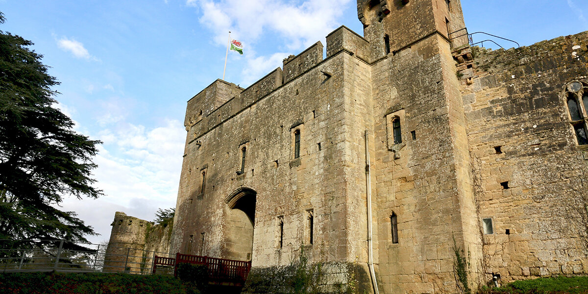
Newport Wetlands Visitor Centre
The Newport Wetlands visitor centre was built in 2008. It has a shop, a café, toilet facilities, an education room and a conference room. The centre is open every day (except Christmas) from 9am until 5pm. Entrance is free though donations are very much appreciated.
Parking costs £3 for non-RSPB members. The car park opens at 8.30am and closes at 5.30pm.
Uskmouth
Archaeologically, Uskmouth is very important, and the area contains features and artefacts from multiple time periods.
The sediment that covers the area is a mix of silt, clay, sand and gravel. It can make it difficult to identify important areas but has created almost perfect conditions for the preservation of ancient remains.
Stand by the lighthouse and look out across the estuary. About 600m from the seawall there have been a variety of prehistoric discoveries, ranging from the Mesolithic (Middle Stone Age, circa 10,000 - 6000 years ago), when humans were still hunter-gatherers, to the Iron Age (circa 750BC - AD43), the period just before the Romans and the start of recorded history.
In 1986, Derek Upton, a local steel worker and keen amateur archaeologist, was the first to find prehistoric footprints at Uskmouth. It was through his discoveries that archaeologists became involved in the area and the importance of the Gwent Levels was fully appreciated.
The footprints dated from the Mesolithic period and included humans, aurochs (extinct wild cattle) and red deer. A variety of skeletal remains of aurochs, pigs and horses have also been found in this area in an ancient river channel (palaeochannel).
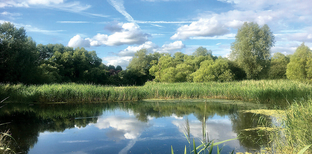
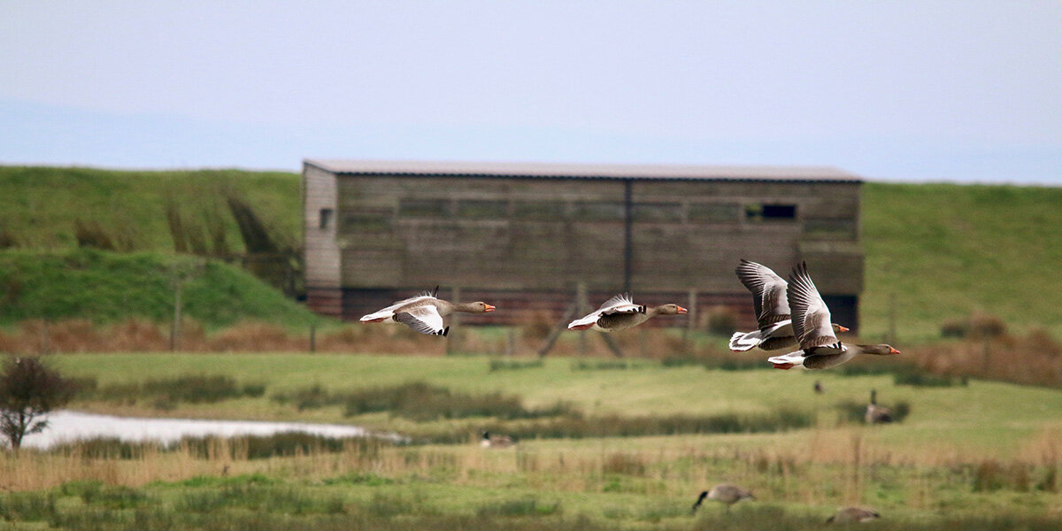
Newport Wetlands Nature Reserve
Newport Wetlands may look like a beautiful natural area that has always been here, but this is not the case. This area was once used to dump pulverised fuel ash from Uskmouth Power Station. The land was given to the Countryside Council of Wales as compensation for loss of wildlife habitat at Cardiff Bay. Since 2000 the area has been completely re-landscaped and now includes saltmarsh, reed beds and saline lagoons, a perfect habitat for a wide range of wildlife.
Beyond the sea wall is an extensive area of salt marsh. This habitat develops along sheltered coastlines and helps to protect the coast from erosion. It is important for a wide range of birds, including avocets, oystercatchers and curlew, and for this reason it is not open to visitors. You can safely view the area from the sea wall.
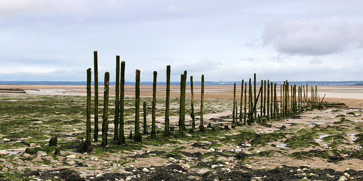
Goldcliff Pill
The Pill is the remains of a tidal creek that has been adapted to drain freshwater from the Levels. At low tide water drains from the Levels through a gate in the sea wall called a ‘gout’. As the tide comes in, sea water pushes the gate closed.
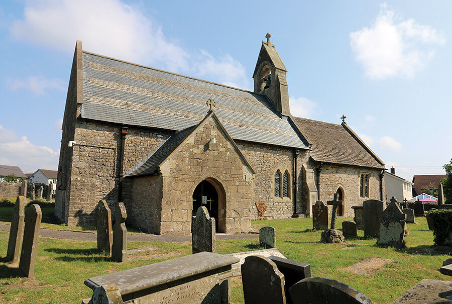
During the medieval period, there was a small port on the pill that served the nearby Goldcliff Priory, which sat on top of Goldcliff Island, the high ground on the opposite bank. The priory owned land between Goldcliff and Nash and was responsible for creating much of the Levels landscape we see today. It was abandoned in the late 15th century and nothing now remains of the building.
In 1878, an inscribed Roman- era stone was discovered near the sea wall at Goldcliff. The stone records work carried out by Roman soldiers based at nearby Caeleon. Although what they were doing isn’t clear, they were possibly building an embankment or digging drainage ditches.
Goldcliff Lagoons
Goldcliff Lagoons is part of Newport Wetlands and consists of a number of man-made saline lagoons.
When the lagoons were constructed, a buried landscape of Romano- British drainage ditches was uncovered. The lagoons were designed so that they did not damage this archaeological landscape.
When the Romans came to the Gwent Levels around AD 100, they constructed earthen embankments to prevent the tide encroaching and dug ditches to drain the land, enabling the creation of a farmed landscape similar to the one we see today.
When the Empire fell and the Romans abandoned Wales, there was nobody to continue the upkeep of these ditches. Through a combination of sea level rise and lack of drainage, the Levels reverted to wild marshland and a thick layer of estuary mud covered the Roman landscape.
The saline lagoons attract a wide variety of birds, including common crane. Cranes were once common on the Levels and their preserved footprints are often found on the foreshore. They were also a favourite dish on Roman dinner tables and were possibly hunted to extinction on the Gwent Levels, as the Roman period was the last time crane skeletal remains were discovered on the Levels. Now, after almost 2000 years, the cranes are back.
Goldcliff Island
On your right is an area of high ground, once occupied by Goldcliff Priory. This is Goldcliff Island. The island once projected far out into the estuary, but it has been greatly eroded over the centuries.
Goldcliff Island is one of the best places to fully appreciate how long humans have been actively using the Gwent Levels.
The Severn Estuary is incredibly rich in Mesolithic archaeology. During the Mesolithic, or Middle Stone Age (10,000-6000 years ago), a large amount of the Earth’s water was still held in ice and areas of land were inhabited which are now completely under water. Due to the fantastic preservation of organic material in the waterlogged environment, these sites contain information about our coast dwelling ancestors.
Spring tides are the best time to view the prehistoric landscape at Goldcliff. Looking out onto the foreshore you may be able to see tree trunks or stumps. These are from a Mesolithic oak forest that developed in this area during a period of slow sea level rise. The forest was eventually drowned when sea levels began to rise again, but many of the trees have been preserved in the mud.
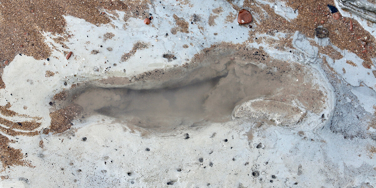
On the very lowest tides (>1m), areas of Mesolithic activity and footprint sites are uncovered.
The Mesolithic footprints at Goldcliff East are perhaps the most famous prehistoric archaeology on the Gwent Levels and have been featured on a number of television programmes.
Prehistoric footprints are ephemeral in nature, meaning that archaeologists are at the mercy of the tide and shifting sediments. Areas exposed one day may be covered by two metres of sand the next and it is vital that they are recorded quickly and efficiently. Also, once uncovered these same tides will quickly erode the footprints, destroying them completely.
So far over 300 human footprints have been found, along with cranes, oystercatchers, herons, white storks, red deer, and wolf prints.
The crane footprints are the earliest evidence we have of crane living on the Gwent Levels, and some of the earliest evidence of crane from all of Britain. These prints were made around 5,600 BC during the summer months, so were likely made by birds using the area as a safe breeding ground and place for their chicks to fledge.
Some of the human footprints have a similar direction of movement, heading directly towards, or away from, Goldcliff Island. There was a site of occupation on Goldcliff Island, and it would seem that these individuals were walking there. They range from children to adults.
If you look out into the estuary you may be able to see the large wooden weirs of the fish traps near the wall. These are built into the Bronze Age reed peat land surface. To the left of these traps Bronze Age animal footprints have been discovered, including red deer, cattle and sheep.
Large numbers of animal prints have been found along the edge of an ancient river channel (palaeochannel), perhaps caused by animals drinking at the water’s edge. The number of juvenile sheep and cattle prints suggests that these animals were being used for milk production, making this some of the first evidence of dairy farming on the Gwent Levels.
Porton
The intertidal zone at Porton is covered by a deep layer of mud and there are far fewer finds here than at other areas along the coast.
Finds include a Mesolithic tranchet axe, reed matting, a Bronze Age palstave and a Bronze Age spearhead, as well as a few potential deer and cattle hoof prints, and two possible Iron Age human footprints.
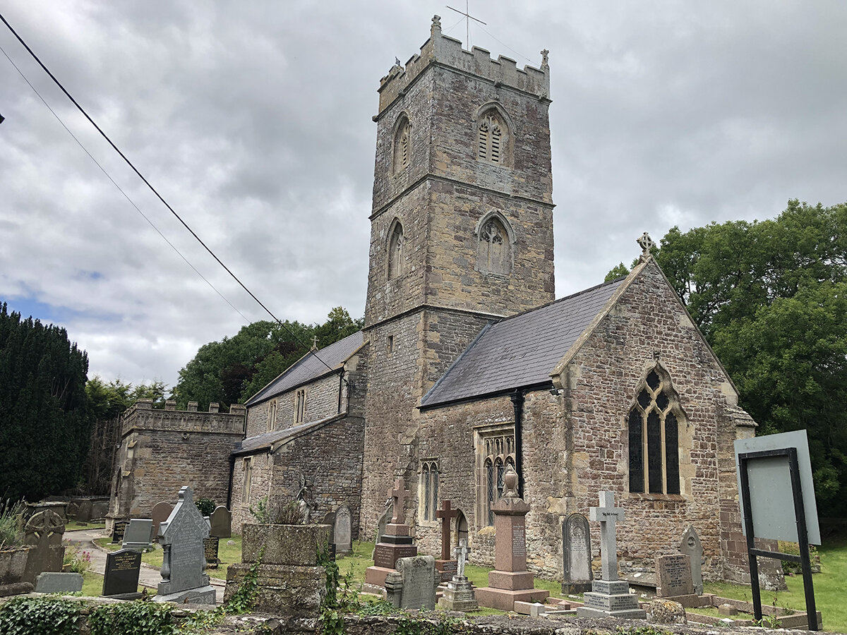
Redwick
The coast at Redwick is rich in prehistoric archaeology.
The peat shelves are Bronze Age in date (1691–1401 cal BC) and have preserved a variety of finds, including four rectangular Bronze Age buildings, a thumbnail scraper, a human cranium, burnt bone, charcoal, and heat fractured stone. There are also footprints from a variety of animals, including humans, cattle, sheep/goats and pigs.
The humble selection of artefacts in this occupation area suggests that these buildings were not part of a permanent settlement but may have been used seasonally during the drier summer months.
The buildings were surrounded by a large amount of trampling by cattle, sheep and goats. These animals were likely from a dairy herd, as many of the footprints were made by young animals. This suggests that the site was being used during the spring/ summer to feed livestock on the nutrient-rich salt-grass.
The peat is occasionally washed clean by a good tide. On these occasions, the location of the buildings can just about be seen, though erosion is wiping out this evidence.
Whilst in the village bear in mind that the English name ‘Redwick’ means ‘settlement where reeds grow’, indicating the strong relationship between the village and the wetlands.
Parking
Park at Newport Wetlands. Parking costs £3 for non-RSPB members. The car park opens at 8.30am and closes at 5.30pm.
Dog policy
Dogs are only allowed in Newport Wetlands along the Wales Coast Path (WCP) and must be kept on a lead at all times. From the RSPB car park, follow the WCP around the outside of the reserve, rejoining the walk route at the East Usk Lighthouse.
Facilities
Newport Wetlands Visitor Centre cafe (Website)
The Farmers Arms, Goldcliff (Website)
The Rose Inn, Redwick (Website)
Accessibility
Fields can be very muddy throughout winter.
Downloads
▶ Download walking route leaflet. (PDF 7.6MB)
Always follow the Countryside Code.
- Consider the local community and other people enjoying the outdoors
- Park carefully so gateways and driveways are clear
- Leave gates and property as you find them
- Follow paths but give way to others where it’s narrow
- Leave no trace of your visit, take all your litter home
- Don’t have BBQs or fires
- Keep your dog under effective control and pick up after your pet – dog mess can harm livestock
- Plan ahead, check what facilities are open, be prepared
- Follow advice and local signs