Distance: 11 km | Time: 3.5 hours | Strenuous Walk
An exhilarating walk from the Newport Wetlands visitor centre, via the East Usk Lighthouse and the Wales Coast Path, to the medieval churches of St Mary’s at Goldcliff and St Mary’s at Nash.
OS Map: Explorer 152 - BUY
Details
Route Description
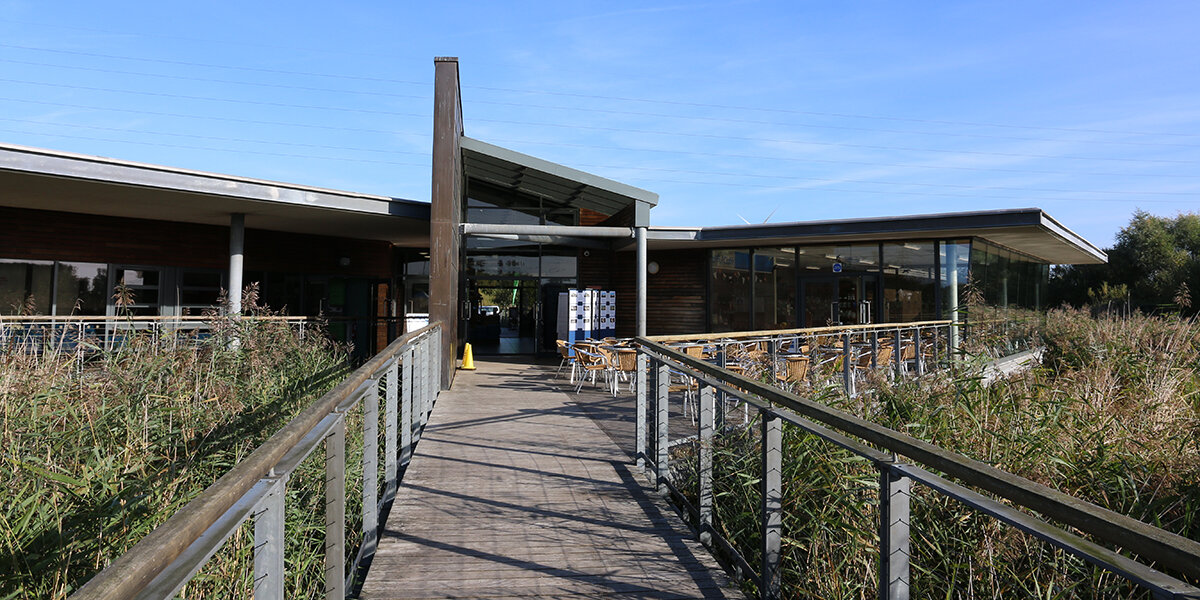
Start at the Newport Wetlands RSPB Visitor Centre. (Grid Ref: ST 334833)
- From the Visitor Centre, follow surfaced path onto main reserve and around the reed beds heading towards East Usk Lighthouse.
Please note: Dogs are only allowed in Newport Wetlands along the Wales Coast Path (WCP) and must be kept on a lead at all times. From the RSPB car park, follow the WCP around the outside of the reserve, rejoining the walk route at the East Usk Lighthouse. - At the lighthouse, turn left along Wales Coast Path (WCP) following the coast towards Salt Marsh Lane.
- Walk along the lane for approximately 500m, then follow WCP waymarks leading you to field path on the right. The route winds across fields and footbridges past Redhouse Farm and onto Goldcliff Road.
- Turn right along road for approximately 120 metres, look out for a finger post again on your right.
- Turn right along a footpath that loops around Goldcliff Pill back to kissing gate onto Goldcliff Road.
- Turn left onto road toward Farmers Arms pub, leaving the WCP. Bear left through the pub car park to St Mary’s Church. Once through the church gates continue along tree-lined path before turning left at the porch, around the tower, to a footbridge at the rear of the church.
- Bear left and follow the waymarks across a series of fields and footbridges towards Henton Farm (point 8). Please note livestock may be present. Dogs must be on a lead.
- Cross stile onto green lane and turn left following the track past Henton farm, before a better surfaced track leads you towards Cross Farm, and Goldcliff Road.
- Turn right along the road for a short distance before rejoining the footpath at a finger post and bridge on your left.
- Follow waymark arrows over several footbridges to Farmfield Lane. Cross the lane and follow the footpath to Nash and St Mary’s Church, known locally as ‘The Cathedral of the Moors’.
- After visiting the church, head diagonally across the car park of the Waterloo Inn to a stile and bridge to rejoin the WCP. Turn left and follow the WCP way marking over several fields to Fish House Lane. Turn left and follow lane for 50 metres before turning right through a kissing gate back towards the Wetlands Visitor Centre.
Walk Highlights
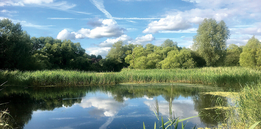
Newport Wetlands National Nature Reserve
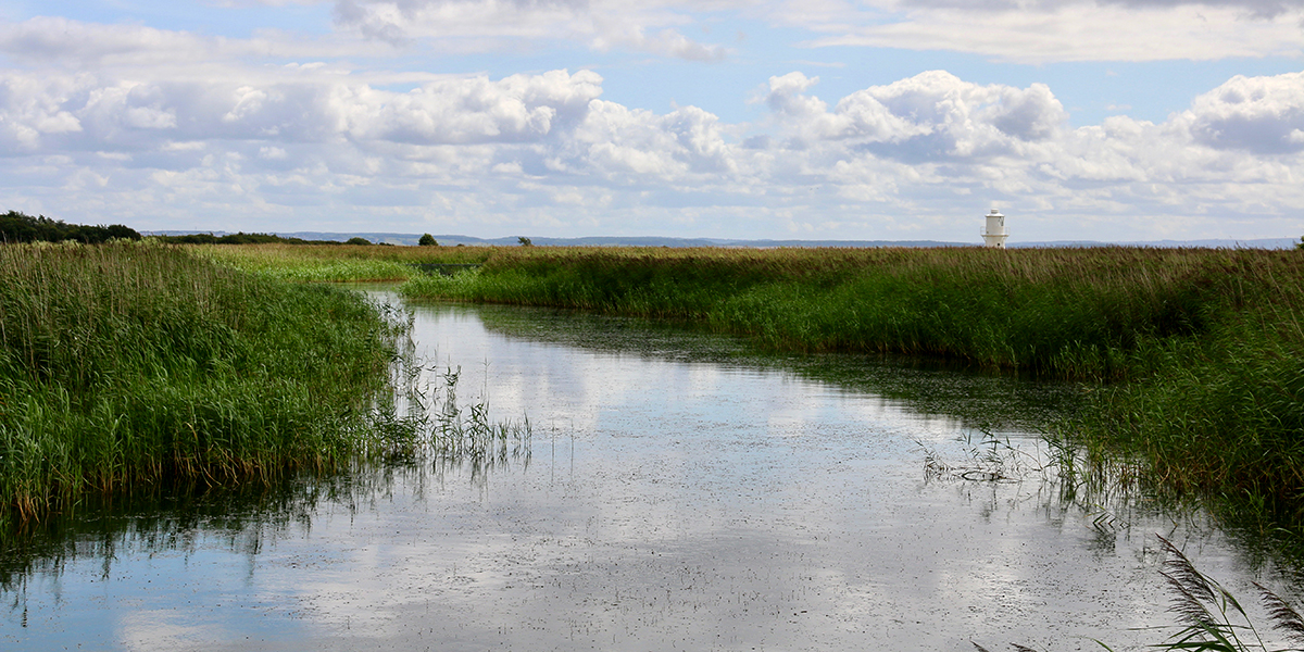
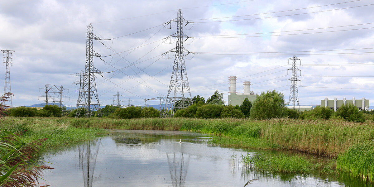
The 866 hectare reserve opened in 2000 and stretches from the mouth of the Usk east along the coast to Goldcliff. It is made up of a diverse range of low-lying habitats, including wet grassland, reedbeds, saltmarsh and saline lagoons, which makes this one of the best sites in the country for viewing bird life (and lots of other wildlife, too).
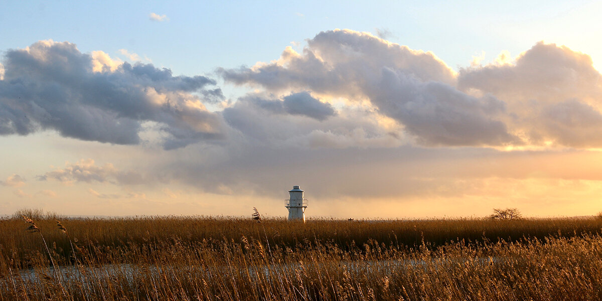
East Usk Lighthouse
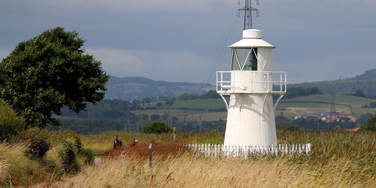
The East Usk lighthouse was constructed in 1893, and is one of two marking the entrance to the River Usk; West Usk Lighthouse has been decommissioned and is now a B&B.
Originally much taller than it now appears, the legs of the lighthouse were gradually buried under fly ash from the Uskmouth Power Station. It was converted from a gas-powered light to electricity in 1972 and is still in operation today.
Goldcliff Pill
Goldlciff Pill is the remnant of an ancient tidal creek that once travelled inland across the Levels. Over time it has been adapted to carry fresh water out to sea; the reen (drainage ditch) known as Monk’s Ditch carries water across the Levels from high ground to the north, through a sluice gate in the sea wall, called a ‘gout’, and out into the estuary.
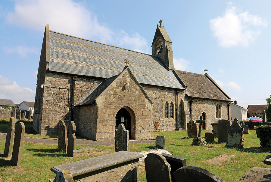
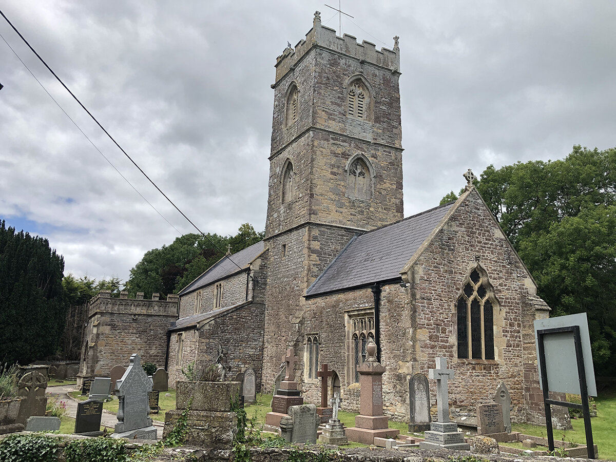
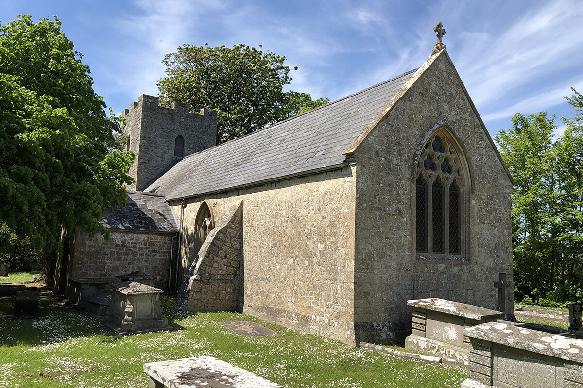
St Mary’s Church, Goldcliff
The tiny parish church of St Mary Magdalene sits within a well maintained churchyard at the end of a grove of lime trees.
The exact age of the building is uncertain. Parts of the building date from the 12th century and some of the stonework may have come from the ruins of nearby Goldcliff Priory. The church's tower possibly dates from the 14th century, but may be much later. The interior of the church was restored in the 19th century.
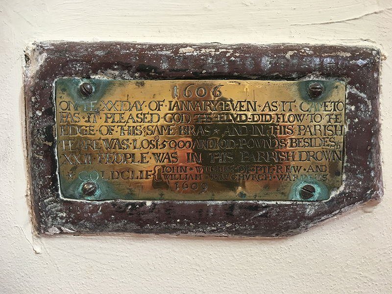
A brass plaque on the north wall of the nave records the loss of property and life during the Great Flood of 1606/07.
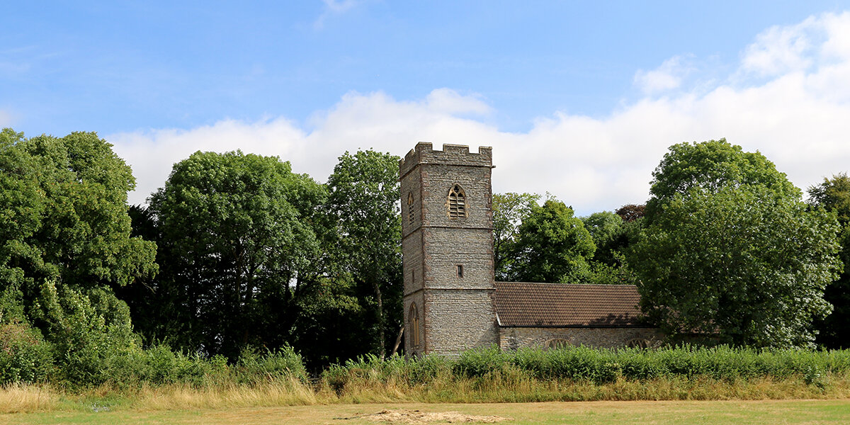
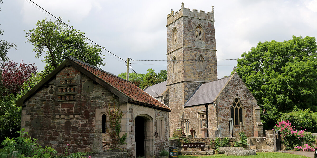
St Mary's Church, Nash

The Church of St Mary’s, known locally as “The Cathedral of the Moors”, is medieval in origin but was extensively rebuilt in the 1500s and little now remains of the original building. The church was once much larger, but the north aisle to the nave was demolished in 1792 - you can still see the roofline on the side of the tower.
The tall 15th century tower has an octagonal spire. At its base, next to a small door, is a plaque commemorating the Great Flood of 1607, marking the height reached by the flood waters.
Inside, the church has a complete set of 18th century furnishings, with box pews, a three-tier pulpit and a western gallery. Look out for the ‘squint’, a peep hole between the room at the base of the tower and the chancel. This allowed an attendant to view the service and communicate with the bell ringers.
Wildlife
Newport Wetlands is best known for its fantastic range of wetland birds, including bearded tits, little egrets and avocets. As you explore the reserve, listen out for the distinctive boom of the bittern, a shy and elusive member of the heron family.
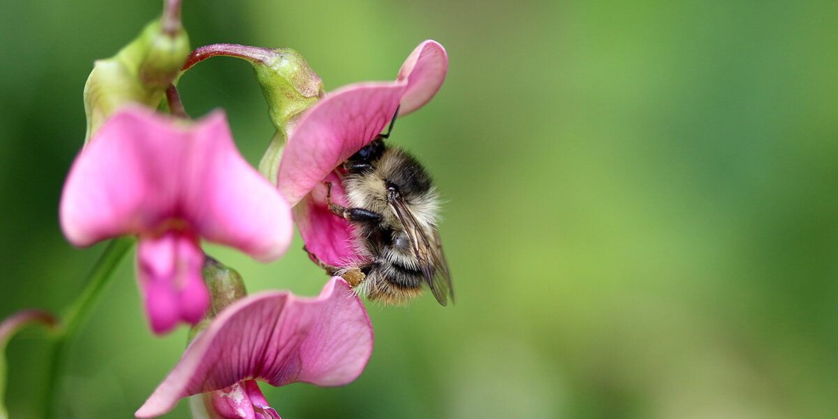
During spring and summer, the reserve teems with butterflies, dragonflies and bees, including one of the UK’s rarest, the shrill carder bee.
Parking
Parking at Newport Wetlands (£5 - RSPB members FREE)
Dog policy
Dogs are not allowed within Newport Wetlands except along the Wales Coast Path (WCP). From the RSPB car park, follow the WCP around the outside of the reserve and join the route at the East Usk Lighthouse. Dogs must be kept under control at all times.
Facilities
Cafe and toilet facilities at Newport Wetlands visitor centre (website)
The Waterloo Inn, Nash (website)
The Farmers Arms, Goldcliff (website)
Accessibility
Several stiles and narrow footbridges to cross.
Fields can be very muddy throughout winter.
Some fields may contain livestock.
Downloads
▶ Download walking route leaflet (PDF 2.7MB)
Always follow the Countryside Code.
- Consider the local community and other people enjoying the outdoors
- Park carefully so gateways and driveways are clear
- Leave gates and property as you find them
- Follow paths but give way to others where it’s narrow
- Leave no trace of your visit, take all your litter home
- Don’t have BBQs or fires
- Keep your dog under effective control and pick up after your pet – dog mess can harm livestock
- Plan ahead, check what facilities are open, be prepared
- Follow advice and local signs
Navigating routes using GPX files
Many smartphones and tablets are GPS-enabled. Using a navigational app, such as the OSMaps or ViewRanger apps, you can use a GPX files to follow a route.
- Install your chosen navigational app before setting out on your walk.
- Download the GPX file from the route page.
- Import the file into your app. How this is done depends on the app you are using.
Please be aware that using your phone's GPS can drain the battery. It is recommended that you carry a paper map as a backup.