Distance: 7.5 km | Time: 2.5 hours | Moderate Walk
A bracing walk from the tiny medieval church of St Mary’s in Undy, across Caldicot Moor, and along the sea wall to Chapel Farm.
OS Map: Explorer 154 - BUY
Details
Route Description
Start at St Mary's Church, Undy. (Grid Ref: ST 440869)
- Start from car park in front of St Mary’s Church, Undy. With back to church, turn right along Church Road for 150m to road junction before railway bridge.
- Take right fork following National Cycle Network route 4 (NCN4) down no through road, passing Church Rise on your right and at next left-hand road bend take path through gap in hedge off to right, opposite house on left.
- Veer left across field known as “the Patches”, following telegraph poles to stile and bridge on left of barn in front of you. Turn right on to lane, follow for 100m to left hand bend.
- Take gate on right in to Undy Pumping Station then kissing gate on right bringing you out behind house. Immediately turn left to follow “sea wall reen bank”.
- Follow path running down between Sea Wall Reen on your right and Collister Pill Reen on your left. You are now walking along the top of part of a medieval sea wall. Go through gate, follow path towards pylon and large old black poplar tree. Follow path to right of tree then cut off corner of field to head back over to Sea Wall Reen, passing to right of pylon.
Please note since publication of the leaflet, the black poplar tree has been felled. - Go through gate in hedge under overhead cables, ignoring bridge to right, follow path on ridge between two reens on either side. Path bends left then right, then go through gate on left to cross over reen and immediately through another gate/stile, then straight across field to gate, turn right on to track and NCN4. After 50m take left turn continuing on NCN4.
- After ¾ km take right turn to sea wall, following Wales Coast Path (WCP) way markers.
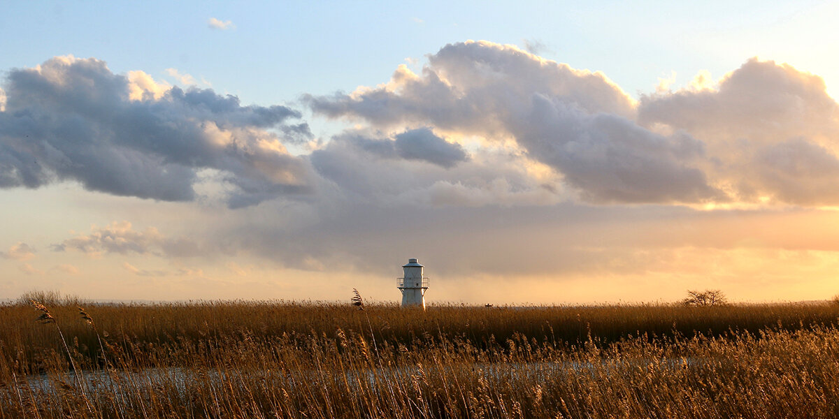
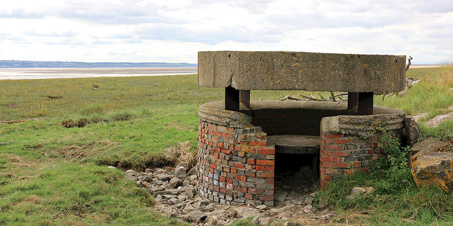
- At end of lane go through two gates and up onto sea wall. Turn right along top of sea wall following WCP. Stop to admire the views. Carry on towards Chapel Farm. The route turns right here past the farmyard of “Pennycloud” but it’s worth carrying on along the sea wall for 100m to see a Second World War coastal observation pillbox.
- Retrace steps to Pennycloud Farm then drop down off sea wall to farm gate, don’t go through it but dogleg to right then left over stile to follow narrow stoned path between hedge and fence around farm buildings to stile and lane, turning left to follow lane for 1km to join the “Causeway”.
- Turn right to follow NCN4 back towards Undy. Turn right in to Undy AFC grounds, keeping playing fields to your left and gardens to your right continue almost too far end, then opposite railway bridge turn right along rough ground back to church where you started.
Walk Highlights
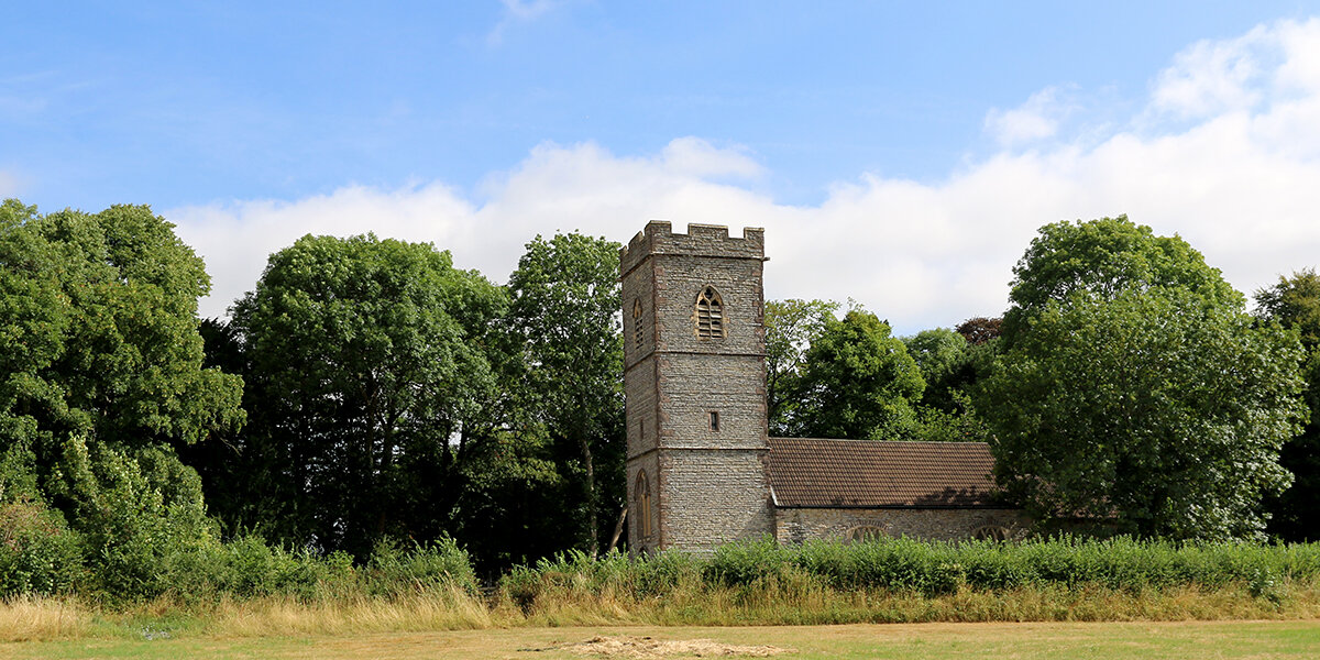
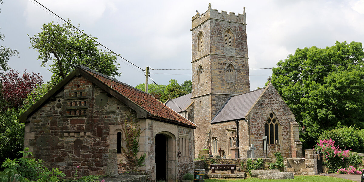
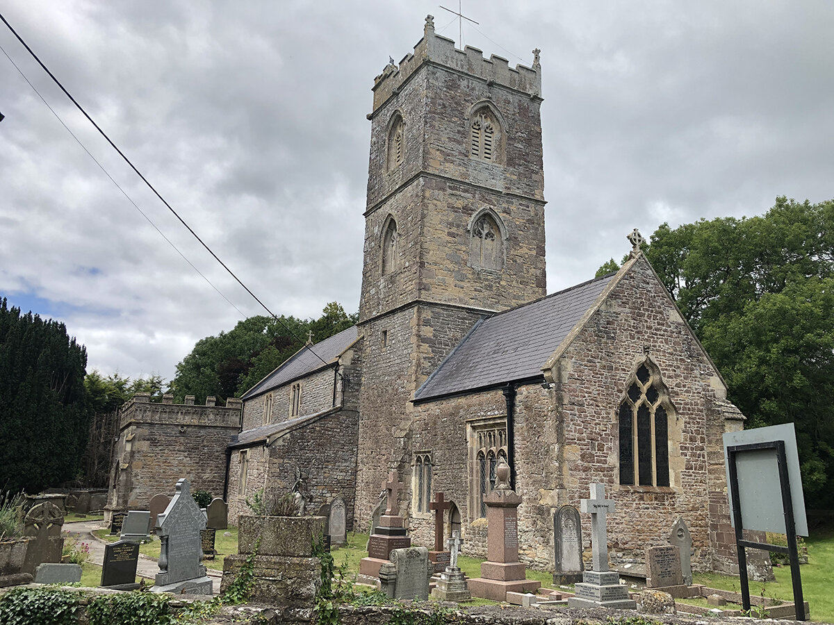
St Mary’s Church, Undy
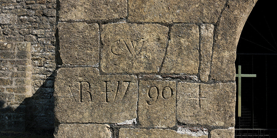
The medieval church of St Mary’s was extensively restored in 1880, when a central tower was removed and replaced with a bell turret. The bell is much older, dating from the 14th century, and is similar in design to the two oldest bells at St Thomas’ church in Redwick. Carved on the side of the porch is the date 1790 along with the initials of the churchwardens of the time.
Medieval Sea Wall
Running along the side of Collister Pill Reen is a medieval sea wall. It was built to protect land in Undy parish from flooding from neighbouring Caldicot Moor, which remained open to the sea until it was enclosed in 1850. The earthen bank is around 2.5m above the land to the west, but is almost level with the land on Caldicot Moor.
Views
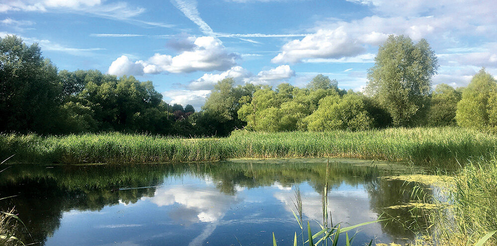
As you walk up on to the sea wall, stop to admire the view.Directly cross the estuary is the port of Avonmouth. The small island 5km due south of you, sitting on the border between England and Wales, is Denny Island, the only registered common land in the parish of Magor. At low tide, farmers used to drive their animals out across the sand banks, known as the Welsh Grounds, to graze on the islands scrubby vegetation.
Looking inland you can see Llanwern steelworks and a huge wind turbine. To the right of that lie three historic hills. First is Twmbarlwm, topped with an Iron Age hillfort and a Norman motte and bailey castle. Further to the right, behind a brewery, is Wilcrick Hill, also with an Iron Age hill fort, one of only two in the country with a spiral design. To the right again is Gray Hill, crowned by an ancient stone circle.
Chapel Farm
On high ground in front of the farm, are the foundations of a mansion and to the side is the site of a ruined chapel. These sites are thought to be connected with the monks of Tintern Abbey who owned and farmed land on the coastal plain.
To your left is the site of a much older historic find. In the mud bank in front of you, an ancient Iron Age walkway was excavated and part of it is now displayed in Newport Museum.
Parking
There is parking at St Mary's Church, Undy.
Dog policy
Please keep dogs under control at all times.
Facilities
There are shops, pubs and cafes in Magor town centre.
Accessibility
Several sections of road to cross.
Parts of route may be muddy during winter or wet weather.
Several kissing gates.
Downloads
▶ Download walking route leaflet.
Always follow the Countryside Code.
- Consider the local community and other people enjoying the outdoors
- Park carefully so gateways and driveways are clear
- Leave gates and property as you find them
- Follow paths but give way to others where it’s narrow
- Leave no trace of your visit, take all your litter home
- Don’t have BBQs or fires
- Keep your dog under effective control and pick up after your pet – dog mess can harm livestock
- Plan ahead, check what facilities are open, be prepared
- Follow advice and local signs
Navigating routes using GPX files
Many smartphones and tablets are GPS-enabled. Using a navigational app, such as the OSMaps or ViewRanger apps, you can use a GPX files to follow a route.
- Install your chosen navigational app before setting out on your walk.
- Download the GPX file from the route page.
- Import the file into your app. How this is done depends on the app you are using.
Please be aware that using your phone's GPS can drain the battery. It is recommended that you carry a paper map as a backup.