
In 1531, King Henry VIII passed the Act of Sewers, creating Commissioners and Courts of Sewers to oversee the management of coastal marshlands, productive but flood-prone agricultural land.
The Courts were tasked with maintaining sea defences and drainage of low-lying areas and consisted of ‘gentlemen’ of the county, often justices of the peace, who were named as Commissioners. Individual landowners were made responsible for the maintenance of sea defences and drainage ditches, and could be compelled by the Courts to carry out work.
There were two separate courts for the Caldicot and Wentlooge Levels, although proceedings were kept in the same book. Commissions ran for 10 years, after which a petition was made to the Crown for a new Commission.
The Court was in operation for the next 300 years until the Act of Sewers was repealed by Parliament in 1930 and replaced by the Land Drainage Act. The Court was replaced by the Caldicot and Wentlooge Levels Internal Drainage Board in 1942.
In 2015, responsibility for the management of the Levels passed to Natural Resources Wales, ending 400 years of local control on the Levels.
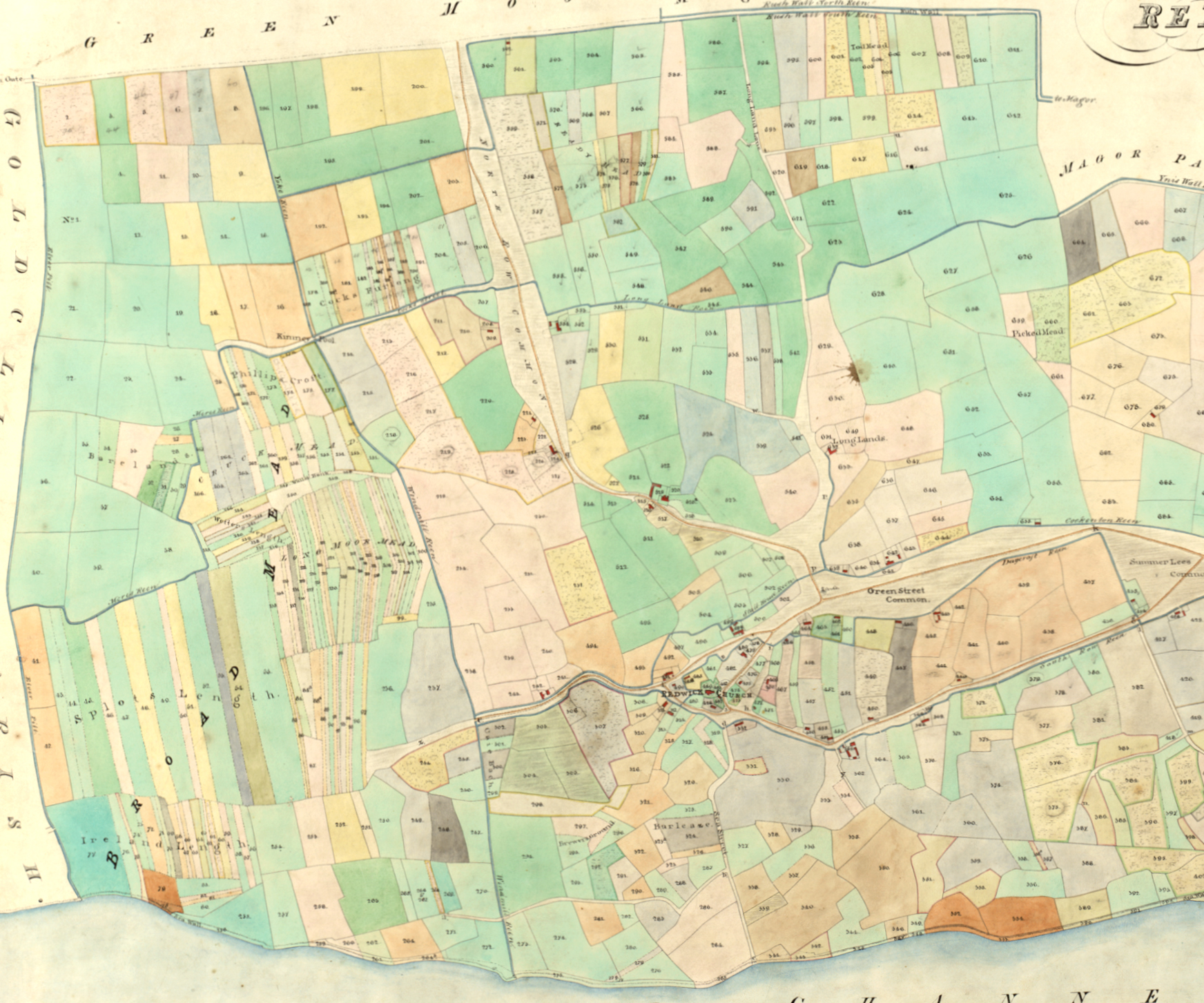
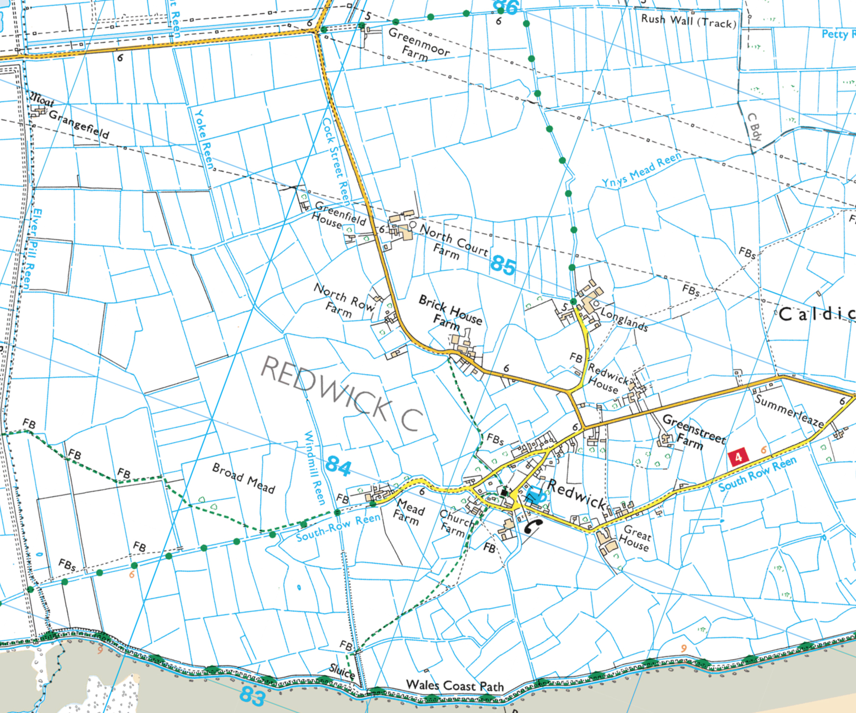
Commissioners of Sewers maps
In 1830, the Commissioners of Sewers ordered a survey of the Gwent Levels, recording land ownership, field boundaries, drainage and sea defences. This was then used to establish responsibilities for the upkeep of flood defences.
Two books of maps were produced, one for the Caldicot Levels and one for the Wentlooge Levels. The works costs around £440 (£27,000 at 2018). These beautiful maps are now stored at Gwent Archives. When overlain on modern OS maps or aerial photographs there is a remarkable degree of conformity.
Move the slider to compare the modern OS map (left) and the 1830 map (right):
© Crown Copyright. All rights reserved. RSPB licence 100021787, RSPB Permit Number: 60271.


![Wesleyan Methodist chapel Castleton (Penny Gregson)[2].jpg](https://images.squarespace-cdn.com/content/v1/5a1d5fb38a02c70db7c34f81/fe4960cd-db68-469d-8411-f5e21327e383/Wesleyan+Methodist+chapel+Castleton+%28Penny+Gregson%29%5B2%5D.jpg)
Commissioner of Sewers map for Nash (1830)