The Landscape

They always say the best way to see the Gwent Levels is with a microscope or a helicopter. You’ve either got to get right in and go, look, this is amazing down here, or you’ve got to get up high and see this vast, extraordinary landscape from above.
A unique Welsh landscape
The Gwent Levels is an iconic, estuarine landscape of international significance. Reclaimed from the sea in Roman times, the Gwent Levels are a criss-crossed network of fertile fields and historic watercourses, known locally as reens.
First impressions of the Gwent Levels landscape to some people are of a flat, unassuming, and relatively empty landscape, sandwiched between the vast Severn Estuary and the extensive urban areas of Cardiff and Newport.
On further inspection however, the Gwent Levels are revealed to be an appealing and remarkable coastal landscape of high skies, low horizons, and a network of narrow watercourses, which together represent the finest example in Wales of a coastal landscape exploited, modified, and transformed by the communities that have lived here since its reclamation from the Severn Estuary in Roman times.
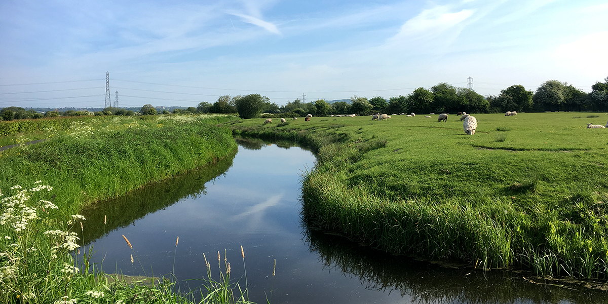
The Levels are a predominantly pastoral landscape drained, irrigated, and modified to allow productive farming, while also providing a diverse range of semi-natural habitats for rare species. The low horizon, level topography, and broad skies, often augmented by dramatic cloudscapes, sunsets, and sunrises, give the Levels a unique ethereal quality.

Water is an ever-present element in the landscape, creating fertile fields and presenting challenges to settlement and occupation of the landscape. Distinctive drainage patterns of canalised rivers, drains, reens and ditches, accentuated by lines of pollard willows, define a planned and reclaimed landscape.
The sea wall, and banks carrying roads and droveways between farmsteads and villages, often form the only upstanding landscape features in some places. Large flocks of wading and other wetland birds visit the coastal mudflats and wetlands attracted by a rich food supply, whilst distinctive and rare vegetation, invertebrates, colonies of water vole and otter are found in the extensive network of ditches, known locally as ‘reens’.
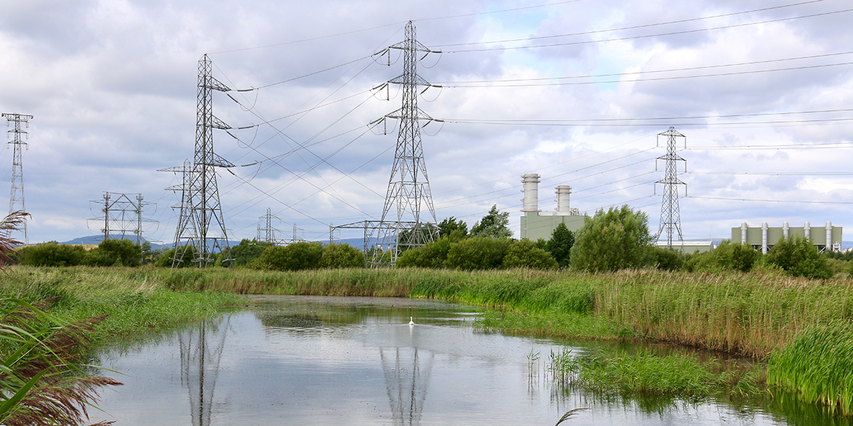
Vibrant cities and towns around the edge of the Levels reinforce its strong sense of tranquillity, remoteness and wildness away from human occupation in many places. In summer, the Levels are a verdant and fertile landscape with lush vegetation across meadows and along watercourses; this contrasts with the wilder remoteness experienced on the Levels in winter.
Starling murmuration over Newport Wetlands (Chris Harris)
6000 year-old footprint, preserved in the estuary mud.
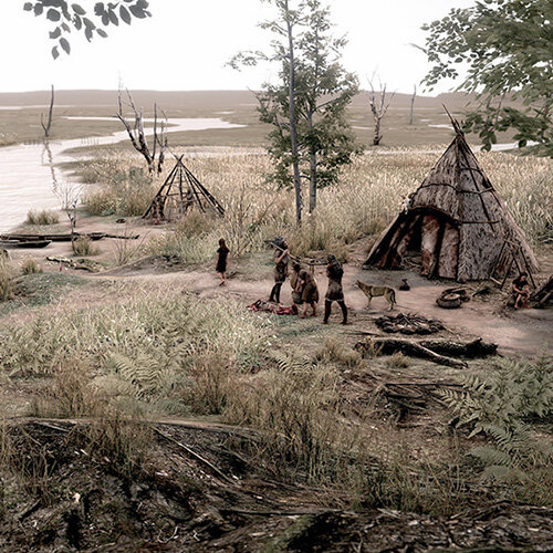
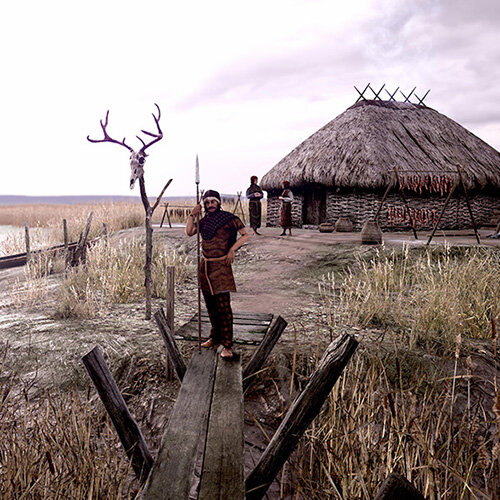
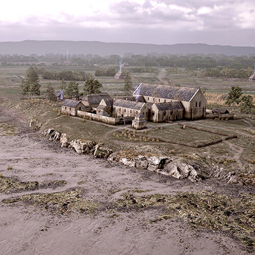
The Gwent Levels are home to a wealth of archaeological and heritage assets of national importance, much within the waterlogged soils across the area, illustrating the history of human occupation and management.
Culture and nature are deeply entwined across the Gwent Levels landscape. The intricate network of reed-fringed drainage ditches and reens criss-cross the Levels like arteries, carrying rainwater water and upland streams safely out to sea to protect the reclaimed land from flooding, and sustaining remarkably ecologically rich wetland habitats of national special scientific interest. It is these living waterways that set the Gwent Levels apart, making them both culturally and ecologically special.
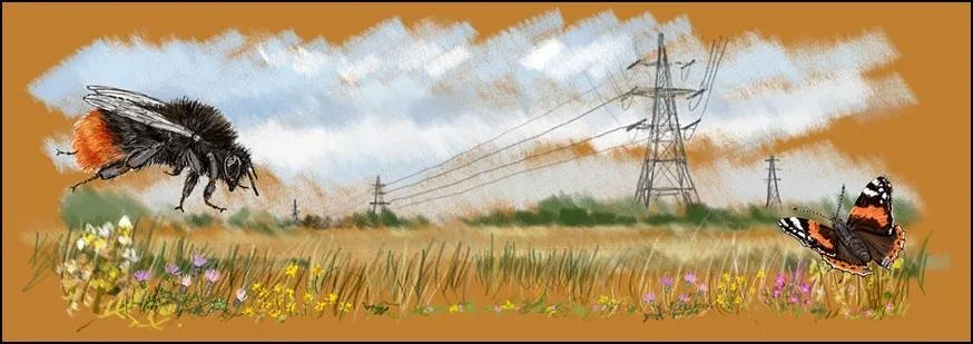
Shrill carder bee (Chris Harris)
The combination of local people managing a dynamic landscape, through systems developed over 2000 years with its associated history, vocabulary, and wildlife, makes the heritage rare, special and a rich resource to be protected and preserved for future generations to enjoy. The national importance of the Gwent Levels as an outstanding hand-crafted landscape is recognised by its inclusion in 1998 on the Register of Landscapes, Parks and Gardens of Outstanding Historic Interest in Wales.
A strong sense of the history of human occupation and management pervades the landscape, reflected in its drainage, settlement and field patterns which create one of the best-preserved planned, medieval enclosure landscapes in Wales. The lay of the land if viewed from above, with reens creating lasting field boundaries, has little changed for centuries and has a striking visual impact.
Key features of the Gwent Levels landscape
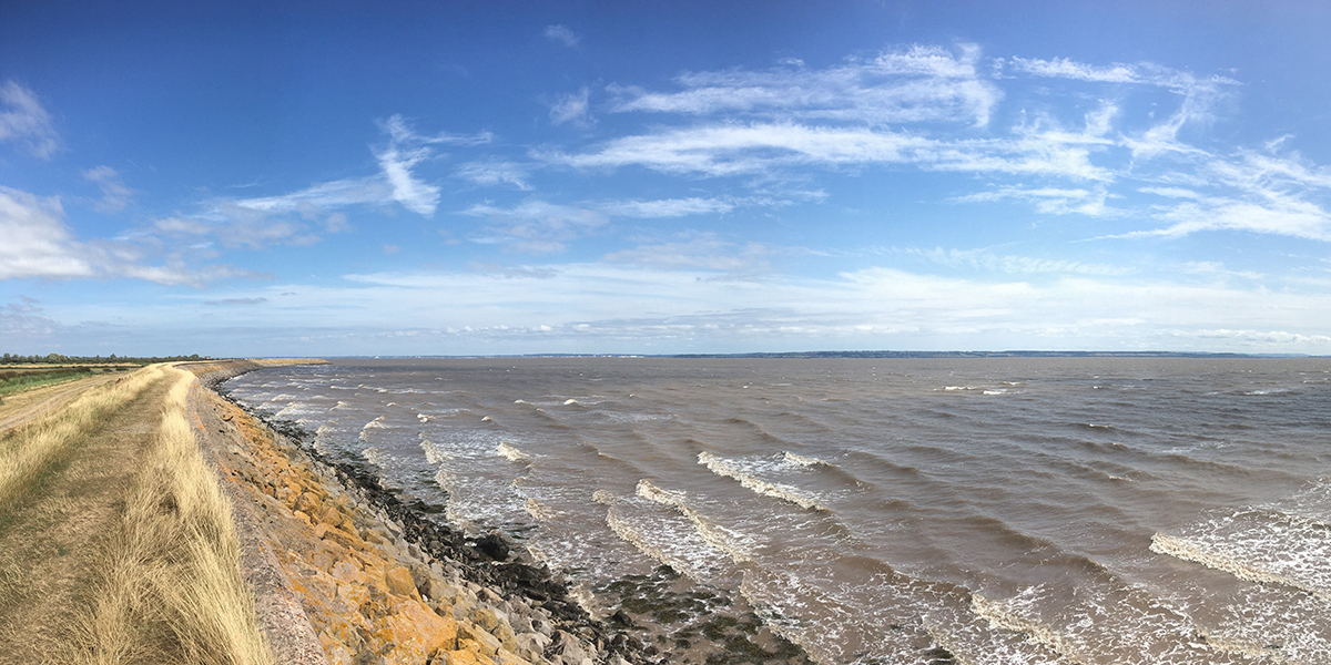
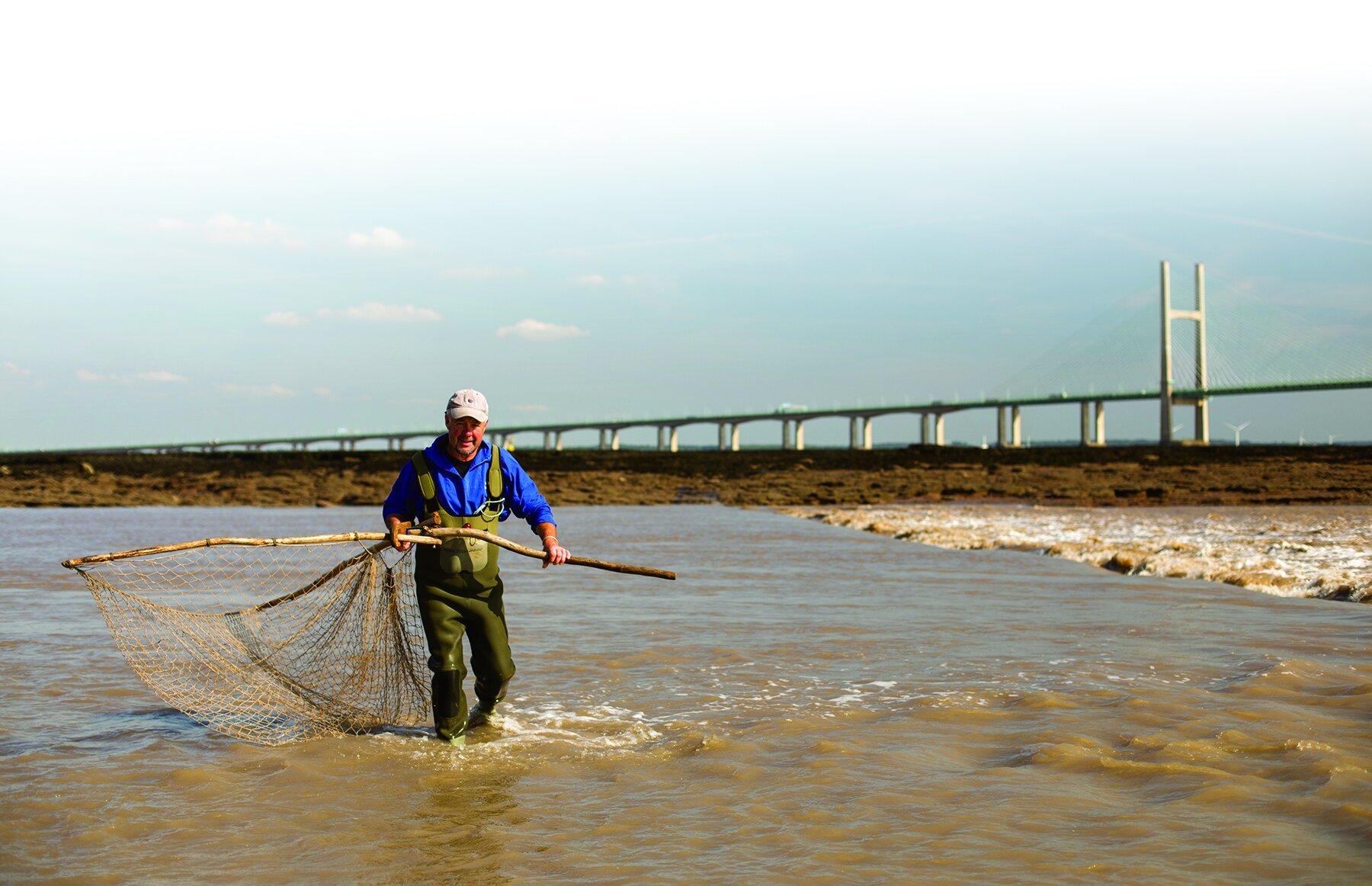
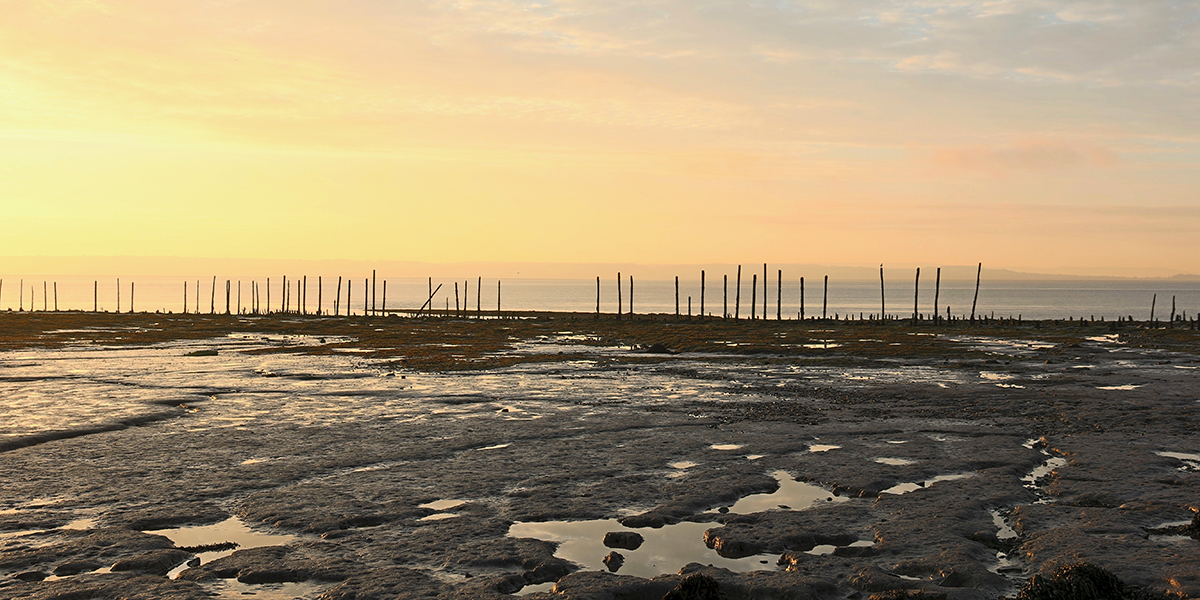
Intertidal Zone: The retreating tide uncovers a vast area of salt marsh and mudflats. This dynamic environment is a haven for wildlife, including rare and endangered species. Read more …
Salt marshes: Salt marshes are a crucial component of the Gwent Levels ecosystem, dominated by salt-tolerant plants. They play a vital role in flood protection, sediment trapping, and water purification, and are an important carbon store. Read more …
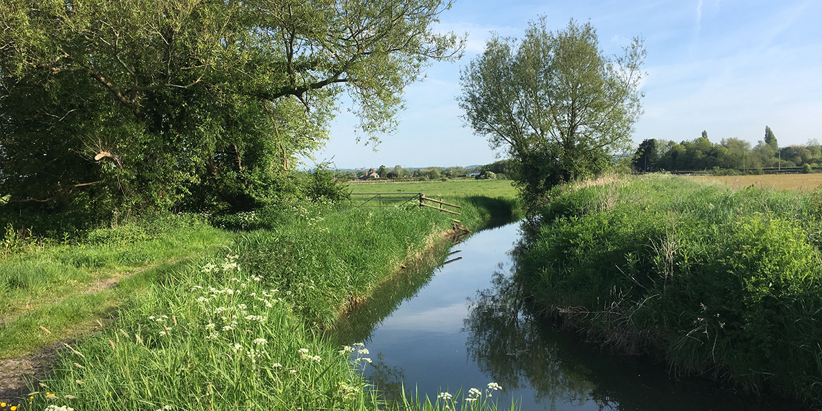
Reens (ditches): The Gwent Levels are criss-crossed by a network of over 800 miles of reens. These man-made ditches serve multiple purposes; reens help drain the land, provide irrigation for agriculture, and act as valuable wildlife corridors. Read more …
Grazing Fields: Most of the Gwent Levels is used for grazing livestock. The fertile pastures, enriched by the underlying alluvial soils, support a thriving farming community. Read more …
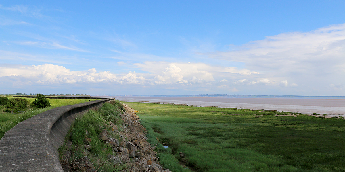
Sea Wall: The Severn Estuary has one of the highest tidal ranges in the world. The Levels is protected from the incoming tide by a 35km long sea wall that dates from the late medieval period. Without it, the Levels as we know it could not exist. Read more …
Biodiversity: The Levels is home to a diverse range of plants and animals, some of which are found nowhere else in Wales. Read more …
Archaeology: The Levels are rich in buried archaeology, both in the intertidal zone and inland of the seawall. Read more …
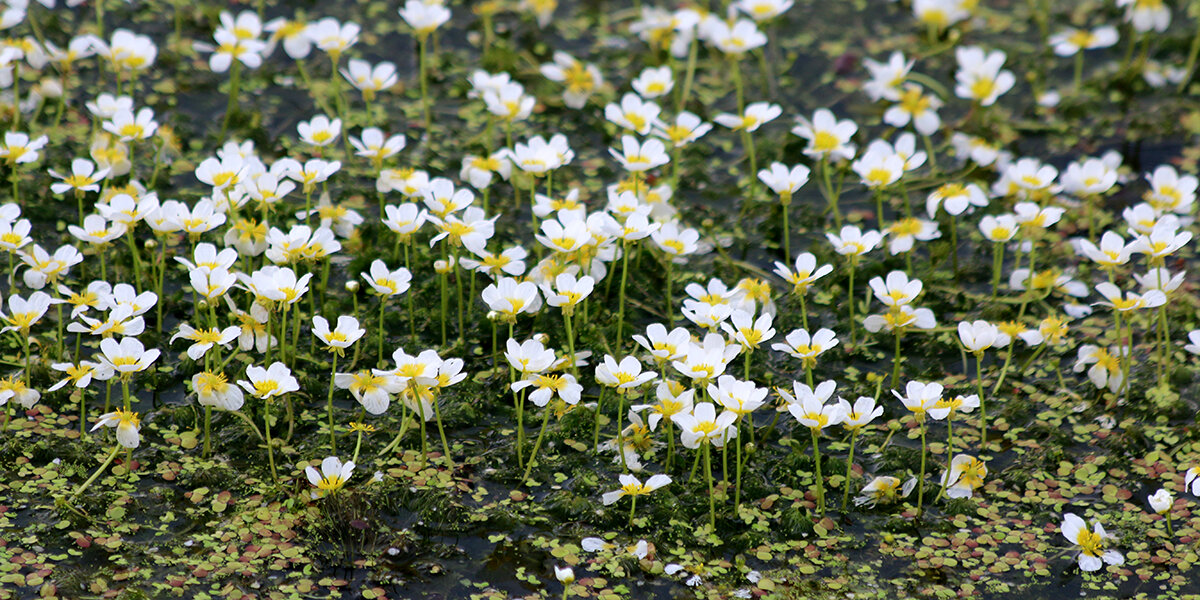
Water-crowfoot forms mats of white flowers in spring and summer (C Harris)
Gwent Levels:
In numbers
- 200km2 – total area, including intertidal area.
- 8 Sites of Special Scientific Interest covering 79km2.
- 1500km of reens and ditches.
- 14m tidal range, one of the world’s highest.
- 35km sea wall.
- 650,000 people live on or next to the Levels.


Radio 4’s Open Country programme visits the Gwent Levels - Listen on BBC iPlayer.